Smoky Mountains: Hiking Serenity in The Cataloochee

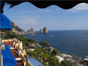
The Great Smoky Mountains National Park didn’t exist before the Great Depression.  Chartered in 1934, the park took in over 800 square miles in eastern Tennessee and western North Carolina.  10 million visitors per year pass through the park, with a large number of them passing along US highway 441 between Gatlinburg, Tennessee and Cherokee, North Carolina.   To the east of this main tourist area, just north of Maggie Valley, NC and just off of I-40 is the Cataloochee.

Settled by white men who gradually displaced the Native Americans between 1800 and the Civil War, the Cataloochee as it is today gives a glimpse of life in the remote valleys of Appalachia at the turn of the twentieth century.  The settlers descendants  were themselves displaced by the creation of the park, leaving behind their houses, barns, fields, churches and cemeteries.  When you go there you will feel the shadows of both the Native Americans and the white settlers, or maybe you’ll just feel the wonderful remoteness and stillness of the place.  Getting there is not difficult, but don’t expect to roll in your RV; you can’t get them around some of the curves in the road.  For an idea of what the road in is  like you might want to take in a video someone posted on You Tube.

The campground is located on the banks of one of the streams flowing through the valley and like most National Park Service campgrounds charges a modest fee for a reservation which can be made online up to 6 months in advance of your trip.  It is perfect for car campers who want to unload their gear from the back of the car onto the picnic table and sort it out from there.  Bathhouses with shower are there, but note that the last time we were there, the filtration system was not working so take along a water purification system or plan to boil all the water you intend to consume.

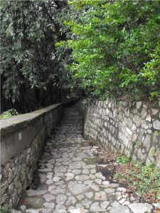
If you proceed down the road a few yards past the campground, you’ll find the trailhead for the Boogerman loop trail.  The trail climbs the mountain on the side of the valley and comes back down to the stream.  Along the stream you’ll find yourself walking across a dozen or more log bridges.

A typical Cataloochee footbridge

Along this part of the trail, you will share space with horseback riders,  but up on Boogerman loop proper you won’t see any horses.  What you will find are some of the foundations of the houses of the farmers who cleared the fields on these mountains and maybe a little rusted tin from the roof of one or two.  You may even feel as though you are trespassing, walking through a forest regenerated from a field cleared with back-breaking work.  Along the way you will come to a low wall, three to four feet high and three feet wide stretching for a hundred yards into the forest.  Most likely, as the field was cleared and plowed, the rocks in the wall were unearthed and carried to the edge of the field, where they were laid into an orderly wall.  As you can see, in the 85 + years since the Park took over the farms, along these hillsides the forest has  reclaimed fields.

Something in the earth doesn’t like a wall

Look for the giant Poplar tree near the wall.  Its base is hollow and two of us stood inside it.  These giants haven’t been seen by everyone.  I could post a picture, but you need to go see it for yourself.

The trail comes back down the mountain past the old farms and rejoins the stream.  If you went along Boogerman loop clockwise, you’ll turn to the right to get back to the trail head.  As we did so, we soon encountered where the forest had tried to reclaim a footbridge.  We made it across, and as you see it was gracefully done.

Footbridge 8, too far along to go back

Back at the trail head you can turn left and drive  or cycle a few miles down into the valley where the meadows still grow tall grasses. You’ll likely see turkey or deer or, if you are out early in the morning or just at dusk, you may encounter a herd of Elk.  Once native to these mountains, a re-population project was started a few years ago with 25 Elk.  From what we have seen the project has been a success and Elk can be found over a wide area of the National Park.  We intentionally went to the meadow at dusk and were literally surrounded by Elk.  Although they know they have to share the meadow with mankind, they remain nervous creatures, so don’t get too close.  They are wild and deserve their space.


Part of the herd in the meadow by the schoolhouse

If you take the road on down past the bridge and the school-house you’ll come to a farm-house and its barn.  Get out and go into both.  Sense the presence of a time long gone.  It reminded me of my grandparents farmhouse that was built about the same time.  I’ll come back with another post about the houses, barns, churches and schools left behind and the Elk who have returned.

A turn of the 20th century home in Cataloochee


Cycle the MS 150 with Goneguru


We have been very fortunate to have been able to enjoy many great outdoor activities.  In addition to hiking and backpacking, we have participated in the Bike Ride Across Georgia  and numerous other group rides.  They have been great fun and a pleasure to for us. However, there is one cycling experience that we have done several times that is more than just personal fun.  The Multiple Sclerosis Society organizes bike rides at diverse geographic locations that actually help people who suffer from MS by raising money to help find a cure.  To date, I am not aware of a cure but these rides help provide the fund s that keep hope alive.  The rides are called the MS 150 because they entail up to 150 or more miles of riding over a two day period.  Here’s the start.

The Start of our First MS 150

This year Goneguru has formed a team and I am asking you to come ride with us, to enjoy the fellowship and camaradarie, to raise funds for the cure, and to feel better about yourself while doing something for someone you likely will never meet, or perhaps, for someone you already know.  The next few paragraphs will share a little about our experiences and then I’ll give you the link to our team page so you can sign up.  Everyone is welcome, even if you just want to come and camp out with us.

 Our first MS 150 was held at Callaway Gardens in rural Georgia about 65 miles south of Atlanta.  Callaway Gardens is a beautiful sanctuary and worth the visit in and of itself.   The start and finish as well as the food pavilion, bandstand, and camping facilities are all inside the Callaway Gardens property.  Additionally, there are hotels and the nearby Franklin D. Roosevelt State Park campground.  The ride itself consists of two days of riding through the rolling countryside around Callaway Gardens and if you choose the longer route on the first day perhaps over into Alabama.  That route would cover roughly 100 miles.  You can choose shorter routes ranging from about 25 miles to about 65 miles.  The second day is all shouter routes, with none greater than 65 miles.  If you are already a cyclist, these distances don’t phase you.  If you are not yet a cyclist, you have time to get in some “seat time” before the ride this September.  This first ride for us was inspired by people we know with MS.  We joined a small team formed by a person with a family member with MS and wore bandana’s signed by the person.  It was great.  Super weather and  beautiful scenery.

Our next MS 150 was a Spring ride in Savannah, Georgia that took us from downtown Savannah, out to the islands along the coast and back to town.  Unfortunately, a mile into the ride the skys opened up and a torrential downpour soaked the course and everyone on it.  I had failed to clean the pads in my helmet before the ride and the rain water washed salt out of the pads into my eyes just as we were passing one of the squares in Savannah.  The pavement was old and cracked and in  a moment when I tried to wipe my eyes, the front wheel of my bike went into a crack running lengthwise in the road, and cause the real wheels to overtake the front wheels.  This condition leads to an immediate rolling effect for the rider and the bicycle with significant impact onto the roadway.  I damaged some ribs and a shoulder in the fall.  As is my custom, I was riding behind the group, so no one in my party saw me go down although a number of other cyclist had to dodge me and the bike.  I checked the bike, wiped my eyes and got back on.  A couple of miles down the road my party was waiting for me.  We soon found a drugstore where I bought the strongest over the counter pain reliever they had and a souvenier ball cap.  The ball cap went under my helmet to absorb the salt and to this day I wear a cloth ball cap under my helmet every time I ride.  It prevents salt blindness and on a sunny day it gives me an extra bill for the eyes. 

Our last MS 150 was back at Callaway Gardens and this time we joined an organized team.  We wound up wearing the sponsors jersey and cycling with a mix of the employees, their parents, and their kids. 

Starting an MS 150 at Callaway Gardens

We also cajoled one of our hiking buddies, Mark, into riding with us.  He’s a great rider and hopefully will be along this time.

This year, on September 16 and 17, at Callaway Gardens we are going to do it again. In the words of the MS  Society “By joining [a] team, you will be signing up not just for a great ride, but also for a celebration of the great things we can achieve when working hard for a common cause. Each mile we pedal together brings us that much closer to a world without MS. So please, register online to join me or make a donation.”

What we hope to do with MS is to see the day when the last Finish banner can come down and no one has to live with MS.

Make this sign come down!

  Come ride with us and pedal the future a little closer.  To join the Goneguru team  follow the link http://bikegaa.nationalmssociety.org/site/TR?fr_id=18479&pg=teamlist to  the  list of teams  sign up, pledge to raise $250 dollars for the MS society, ride until September, then come camp and ride with us.

Hiking into the land of the Grizzlies: Glacier National Park

In the summer of 1967, two young women were killed by separate grizzly bear attacks on the same night in Glacier National Park.  When you hike or backpack the Highline Trail to Granite Park Chalet you will be visiting the site where one of the incidents took place.  Prior to that time, watching the grizzlies forage through the trash and food scraps discarded by the Chalet into a nearby ravine was considered suitable amusement for the overnight guests at the Chalet.  In fact the Chalet had even set up lights in the ravine so that the guests could see the bears better.  The entire story of the night is told in the book The Night of the Grizzlies by Jack Olson.

Granite Park Chalet from across the feeding ravine

We began our hike to Granite Park Chalet at the intersection of the Highline Trail and the Going to the Sun Road at Logan Pass.  Although it was July, you will see snow in pictures and the road, which traverses Glacier National Park, had only opened in late June.  Glacier sits astride the Continental Divide and the water from the winter snows flows east to the Gulf of Mexico, west to the Pacific Ocean, and north to the Hudson Bay. The Highline Trail hugs the sky just below the Contiental Divide.  As you begin hiking you are on a narrow ledge of a trail across the Garden Wall and at times feel suspended between heaven and earth, but the trail is mainly level without significant changes in altitude, so the walk is exhilerating.  You are hiking at about 8000 feet above sea level almost all the time.

Looking down on Going to the Sun Road from the Garden Wall

Mary, the Seer, takes all the great photographs in this blog and with her camera in her hand she knows no fear. Neither height, nor wind, nor wild animal can deter her from getting that shot.  Along the Highline, we had all of the above. After hiking for a while, we came to a pass that was still covered with snow, but it had melted down to where the snow was only about a foot deep and had become well packed.  We carefully picked our way across the snow circling around a projecting formation known as Haystack Butte.  As we made our way between the high ground of the Continental Divide to our right and Haystack Butte, Mary whispered, “look!”  Before I could say be careful, she had slid her backpack to the ground and had the lens cap off her camera, already walking across the packed snow toward the long slide down to the Going to the Sun road.  And there, right in her viewfinder was the magnificent Bighorn Ram in the picture below.

Bighorn Ram on the slippery slope

The ram was, of course, too smart to really get himself into danger, so after a moment  of teasing eternity, he turned and walked back toward the area where the snow had melted, never in a hurry and never showing any real concern for the hikers.  Finally, he turned and posed for Mary to get the shot she wanted, and we moved on down the trail.

His Majesty

Granite Park Chalet is about 7 to 8 miles along the trail from Logan Pass and the picture below is probably close to half way there.  It was along here that we encountered the first of many mountain goats.  Each was a female with a kid.  The kids, in each instance only a few weeks old, skipped over the steep slope as if it were  a living room carpet.  Of course, while the kid was playing at a distance Mary got up close and personal with the mama’s.  As you can see, the mama has a face only a kid could love.

Mama Goat losing her coat

The Highline Trail is above the tree line here so the veiws are more than spectacular.  They don’t call Montana the Big Sky Country for nothing.  As you walk along you can’t keep your eyes on the trail because the vistas draw you into some quietly peaceful place.  The sound of the cars churning up the road were gone long before we reached Haystack and here you are alone with who ever you are hiking with and God’s creation.

Looking down the valley toward Lake McDonald

More than a mile from Granite Park Chalet we can see the building sitting on a ridge jutting out into the valley.  As with most hikes, it seems tantalizingly close and infinitely far away after you’ve already walked nearly 7 miles in splendid unbelievable air.  Amazingly, we had beautiful blue sky as well as the sure threat of rain, which came and went in a matter of minutes dropping the temperature at least 20 degrees.   A sign that, at  this elevation, change is constant, rapid and certain.  As we walked across the yard to the Chalet, we passed an offset room to the back of the building.  In the 1920’s when the Chalet  offered full service to its guests, this room had held the meat and other provisions.  Notice the spikes on the shutters.   Where people are, bears follow.

A shuttered window with anti-bear spikes at Granite Park Chalet

As I understand it, Granite Park Chalet and Sperry Chalet as well as the Great Lodges at Glacier National Park were built by the Railroads in their heyday between 1912 and 1920 to attract tourists who would take the train to Great Lodges and then travel to the Chalets on horseback.  At that time, meals were prepared for the guests and a larder was stocked for their pleasure.  Now, there is a kitchen which is available for you to use to cook what you carry and bunk beds in common rooms for you to sleep in.  The cooks and other servants have been gone for decades.  The view is as beautiful as ever.

Part of the view from the front porch of Granite Park Chalet.

Although the two bears responsible for the deaths in 1967 were euthanized, there are still plenty of grizzly and brown bear in Glacier.  We saw a couple of grizzly through a telescope mounted on the porch at the chalet.  We happened to be looking back along the Highline and saw the bears down in a meadow below it.  On a hike further west, which I’ll tell you about in the next Glacier post, we saw where the grizzlies had churned the ground looking for food.  As you might have expected, no one feeds the bears at Granite Park Chalet, and when you cross the ravine where the feedings once took place, it is impossible to not look over your shoulder.

I’ll be adding posts about Glacier from time to time, but I can’t tell you all you want to know.  If you are interested in the trip we took contact Glacier Guides and Montana Raft Company.  Another resource you might find helpful is http://www.bigskyfishing.com/ .

Hiking Capri: A Taste of Capri

 As any hiker, backpacker, cyclist or traveler knows, more than an army travels on its stomach.  On our hiking trip around the ISLE OF CAPRI, we did not stuff our backpacks with energy bars or gue or gells, but rather we decided to live off the land.  That is to say, we bought our meals at whatever local establishment was nearby when it was time for us to eat.  This was not our first trip to Italy, but we had never been to the Amalfi Coast, so we had certain foods that we thought we would like to try in this region.  Of course, there was the Caprese sandwich and the seafood and pasta dishes that you might imagine.  To be short and to the point, the food was worth the trip.

Each morning, we had breakfast at our hotel while sitting on a terrace looking out over the Mediterranean Sea, which could have made the food taste better, however, the food stood on its own merits and the view was desert. 

Veiw from the hotel terrace

We made it a point to be in the town square of Capri at midday on one day to try a Caprese sandwich from a shop in the corner with a shady awning covering chairs and tables spilling out onto the courtyard.  You may be surprised to learn that there is a dual pricing system in effect at some of the restaurants.  You cannot buy your food for “take away” and then go sit at a table in the courtyard.  The “dine in” price includes the privilege of sitting at a table but the “take away” price does not. 

Clock tower at the square in Capri

The Caprese sandwich was worth either price!  Fresh baked bread, beautiful sliced tomato and mozzarella cheese with olive oil dressing.  You’ll have to walk there to understand how good it was.

On another day, we were in Marina Grande near lunch time when we noticed a family sitting on a curb eating sandwiches that looked to be delicious, so of course, we asked where they got them.  “Over there,” was the reply from a face buried in a sandwich.  With some confusion we looked across the street to the facade of a building that didn’t look exactly like what we thought a sandwich shop to look like.

A store in Marina Grande

Up and down the street had been restaurants with chairs and waiters.  Still we stepped through the open door into a wonderful Italian deli.  We asked the lady behind the counter at the front whether they sold sandwiches and she motioned us to the rear of the store.  As we got to the rear of the store we found ourselves, at the back of a crowd at least three deep in front of a chest high meat cooler with windows in front and two men behind the counter who each wore the Face of Italy.  With well practiced routine, they patiently listened to each customer then pointed to the ingredients for the sandwich and crafted the little masterpiece.  Little is the wrong word because the sandwiches could not be held in one hand.   For a price that was unbelievably low, we took our sandwiches to the street and sat on the curb near the boats reveling in the sun, the smell and the taste.

Half the Marina Grande sandwich

On at least two afternoons, perhaps on the way back from Villa Jovis or on the way to Arch Natural, we passed an ice cream shop.  Our first stop was curiosity, but our second was decadence.  The ice cream was delicious and as with the little store in Marina Grande, the people behind the counter were scrambling as hard as they could to keep up with the calls of their customers.  It was almost surreal to stand on the street holding an ice cream in your hand while looking through the windows at name brand shops featuring fineries of all types and being exquisitely happy to have ice cream instead of any of them.

In the evenings, we walked back up from Marina Picolla to the Pizzetta and dined at the restaurants, the one we went back to for a second meal was Longano and of all the delicacies in the restaurants we ate at, the seafood risotto from Longano was the meal that we agreed was the taste we had come looking for.    Although the Caprese sandwich is the Taste of Capri, the seafood risotto was the taste of the trip.

Hiking Capri: From Marina Grande to the top of Mt. Solora

Our Italian hiking trip to Capri found us staying on the southern side of the Island at Marina Piccola.  Although there are many fine hotels in the town of Capri, which sits astride the middle of the Isle de  Capri, we chose to stay at the Hotel Ambassador Weber, mainly because it was right on the sea, which I prefer and because it was reasonably priced.  Our window did indeed look over the sea, the beach below, to our left the Faraglioni and to our right the cliffs rising up to Mt. Solora.

The view from the Ambassador Weber

The staff at the hotel were very friendly and always tried to help, even pointing out trails along the map of Capri that they provided, however, when we told them that we wanted to walk up  La Scala Fenicia, the concierge looked at us with dismay and exclaimed, “Oh no, it is very tiresome. You do not wish to do this!”   We persuaded him that we did indeed want to go see the staircase, but we did not tell him that we intended to go all the way to the top of  Mt. Solora, so he directed us to the other side of the Isle de Capri to Marina Grande, where the staircase begins a few feet above sea level.

To get to Marina Grande from Marina Piccola, we walked up a brick pathway to Capri and then took the funicular railway, an inclined railway running between Capri ad Marina Grande.  If you go to the Isle de Capri, your trip is not complete without riding it.  From the Funicular we walked past the beach and docks up the road to the west of

Boats at Marina Grande

the fishing boats, then turned south with the street until we came to a small sign near the Church of St. Constanza marking the bottom of  La Scala Fenicia.   The staircase has approxiamtely 900 steps cut into the granite from the port to the town of Anacapri.  For centuries, this staircase was the only way to get from the port to Anacapri.  Although the name implies that the steps were cut by the Phonecians, they are likely to have been hewn by the Greek settlers of the island instead.

The climb takes you past the residences, school, and olive gardens and fields. As you look back down the steps, the fishing boats in the marina grow increasingly smaller and the climb becomes steeper and steeper.  You look up to see where the staircase may come out and wonder if you can get there.  Eventually the trail crosses the modern road to AnaCapri, and as you walk from beneath the roadway people look at you as though you were insane. It is probably the fact that  your mouth is hanging open gasping for air.   Above the road the steps continue, and the panorama below you grows ever larger until you come to Villa San Michelle, built by Axel Munthe and now a museum.  There, you find yourself on a street passing little shops and leading into Anacapri.

La Scala Fenicia above the road  

We walked through the town and found our way to the Church of St. Michele.  The floor of the church is a hand painted tile depicting the explusion of Adam and Eve from the Garden of Eden.  Walkways around the floor preserve its beauty and  allow you to see it up close, but you won’t appreciate it until you climb the staircase and look down from the galleries above.   We returned to the center of town and debated taking the chair lift to the top of Mt. Solora.  However, we decided to walk instead, so we cut across the village to the east of the cable line and soon picked up the trail.  It was a moderate hike through a pine thicket so that you only saw the cable cars passing overhead occassionally.

The cable Cars to Mt. Solora

After about an hour, we had passed the spur leading down to the  Hermitage of Cetrella and were making our way to the summit of Mt. Solora.  As with most of the island, here you find the ruins of by gone battlements and outbuildings, in a setting so picturesque as to defy imagination.  Looking down to the east we can see the Faraglioni east and south

Faraglioni from atop Mt. Solora

of Marina Picolla.  Jutting out at the far eastern point of the island is Villa Jovis, with Capri and Anacapri on either side of the island. The sea below is a multi-color pallet

Anacapri from atop Mt. Solora

and you wish not to leave, but the small cafe is closing and it is clear that they want everyone to leave.  The few tourists, besides ourselves, and the cafe staff board the cable cars and head down while we return to the path and hike our way down to AnaCapri, where we catch the bus back to Marina Picolla.  It was a great day.

Hiking the White Mountains: Hut to Hut

Hiking the Southern Presidential Range of the White Mountains along the Appalachian Trail  is a test for an outdoor adventurer of any level.  The mountains are beautiful, but the layer of soil over the granite building blocks of the mountains is extremely thin and you will find yourself walking on, over and around areas of exposed rock throughout the hike.  That should not dissuade you from the hike, however, since in our group were people in their early twenties and mid-seventies.  Each handled the rigors of the hike and finished with smiles.  We met at the AMC Highlands Center  at Crawford Notch in northern New Hampshire and followed a well marked trail that crossed the road  and lead us up the mountain to  the AT.  There are stretches along this hiking trail  where you will believe it was designed for goats. 

The access trail from Crawford Notch to the AT

Note that the Highland Center is at 1900 feet above sea level. In a few hours or so you’ll reach the AT and from there on you follow the ridges and flanks of the mountains.  It was on this hike that we learned the meaning of the term “peak bagging.”  During our first night on the trail, at a hut named Mitzpah Spring Hut, one of the AMC hut workers  gave a seminar on the subject.  At first I thought he was saying Peat Bagging, then he explained that peak bagging entailed reaching the summit of a named mountain rising at least  4000 feet above sea level (asl).  Mitzpah Spring Hut sits at 3800 feet asl  on the south flank of Mt. Pierce.   To get to Mitzpah Spring, we scrambled up the access trail to the summit of Mt. Webster where we picked up the AT and headed north, summitting  Mt. Jackson before getting there.  So we had  “bagged” our first peak on this hike before we even knew what the term meant.  The “hut” sleeps 60 in coed bunkrooms that accomodate up to 8 people.  You must eat what you put on your plate because everything used at the hut must be carried in and everything left must be carried out.  After the hike from Crawford Notch, you will have no trouble cleaning your plate.

 The next morning, we hustled up Mt. Pierce, bagging our second peak and set off up the AT toward our goal for the evening. The summit of Mt. Washington which is one of the the highest peaks east of the Mississppi River and the site of the highest recorded winds on any continent on earth, clocking in at over 200mph.  To get there we followed the AT and loop trails to summit Mt. Franklin, Mt. Monroe and Mt. Eisenhower  before we reached the Lake of the Clouds Hut in the saddle between  Mt. Eisenhower and Mt. Washington. 

Lakes in the Clouds Hut

After checking in at the hut, which sits at 5050 feet asl, we dropped our backpacks and headed up Mt. Washington.   We reached the peak late in the afternoon and rather than backtrack down the trail we headed down the far side of Mt. Washington and back around the flank of the mountain to Lakes of the Clouds Hut.  Our plates were dutifully cleaned and we were elated to sit at the dining hall tables and look at a beautiful New Hampshire sunset.

Sunset from Lakes of the Cluds Hut

I’ll post more pictures of the terrain in the next post on hiking the Southern Presidential Range.


Secluded Beach – Cumberland Island

Although Cumberland Island is a National Seashore, there is no bridge to get there, and we all like it that way.  This treasure is the southernmost barrier island off the coast of Georgia (USA) at the mouth of the St. Mary’s River.  Although inhabited for thousands of years, since the 1970’s most of the island has been under the control of the National Park Service which limits the number of visitors to the island to about 300 per day.   The island is 17 miles long and 3 miles wide, so there is plenty of room to separate yourself from the crowd.  Technically, there are some private landowners remaining on the island who are heir’s of the Carnegie’s and other long gone islanders, whose history is chronicled in the book Strong Women, Wild Horses, among others.  I’ll only touch some of the island history to help you understand the place before you make your visit.

Other than the few private landowners and the Park Service employees, there are no vehicles allowed on the island, thus, for those of us who like hiking in serene silence away from the world, this is one of the places where most of the time you’ll be satisfied with what you hear.  One shell packed road runs the length of the island and the eastern side of the island beaches on the Atlantic Ocean, so the beach is immense and virtually deserted.

Stafford Beach on Cumberland Island

The picture above is of the beach three miles from the ranger station.  You can get there by walking or renting a bicycle and cycling along the road.  Otherwise, you won’t see it.   There are no developments on the beach and access across the dunes to the beach is restricted to a dozen or so well marked lanes.  So, how do you really get to this reclaimed beauty?  Read on.

If you have a private vessel capable of navigating the intercoastal waterway, you can get to Cumberland Island by yourself, but most of us rely on the ferry which is authorized by the NPS to carry visitors from the dock at St. Mary’s, Georgia to Seacamp dock on Cumberland Island.  The ferry runs twice a day, once in the morning and once in the afternoon and takes about 45 minutes to get to make the trip.   Pay attention to  your return trip departure time because, although they count heads on the way to the island, they have no way of knowing how many are supposed to be on the boat on the way to the mainland, therefore, they don’t  try to account for your return.  There are also no provisions available on the island, so take your own water and food or buy some on the ferry.  If you are making a day trip and want to rent a bicycle, you have to do it on the ferry.  If you are staying overnight and want to buy firewood, the only place you can do that is on the ferry.

Once you are on the island, the choices and the distance between choices make the decisions for you.  We wanted to backpack to Stafford Beach and camp at the campsites there.  Another group that ferried over with us had young children and were headed to the campsites at Seacamp.   A young couple on the ferry were backpacking a couple of miles beyond Stafford Beach and camping  at an even more remote backcountry campsite.  As you

Boardwalk over the dunes to the beach at Seacamp.

guess, each option had its advantages and drawbacks.   Seacamp is the closest to the dock and ranger station and about 1/2 mile along a sandy trail across the island.  A number of campsites are arranged for substantial privacy and the campsite has running water, showers, toilet facilities and a group area.  The boardwalk shown above leads from Seacamp over to the beach.  You will have miles of beach in either direction, but you will be sharing it with the largest concentration of people on the island.  Stafford beach is 3 and 1/2 miles from the dock along the parallel trail which is well-marked.

Parallel Trail to Stafford Beach

The trail more or less parallels the road, but is a far more enjoyable and easier hike. The trail cuts through the palmetto fronds beneath the live oaks and you soon lose sight of the road  or where you came from.  Watch your step because wild horses and wild hogs share the trails with you and leave their souvenirs along the way.  As plentiful as the dung was, we never saw the hogs, although the population is such that the NPS has had to institute hunts to thin the herd.  The twisted shapes of the live oak trees, the leaves filtering the sun and the limited distance visibility give the landscape along the trail a mystical and unreal quality.  You would not be in the least surprised  to see any creature from folklore stick his head around a tree and look at you .  In all likelihood, you will see the wild horses on the island.  They run free on the island at the command of Ms. Lucy Carnegie, grand dame and matriarch of the island’s Carnegie clan, as set forth in her will decades ago. At the time of the American Revolution, the live oaks were harvested for use in the sailing vessels of the day because of their great strength and resiliency.  Barrier island oak was used in the USS Constitution  and can be seen today if you visit the ship in Boston.

When you arrive at Stafford Beach camp, you can select from one of less than 20 campsites equipped  with a fire ring.  There is a common bathhouse with a cold water shower and toilets, however, any water from the area including the bath house has to be treated by boiling, filtering or chemicals before it can be consumed.  Don’ t even brush your teeth with untreated water.  Your campsite can range from extremely private to rather private depending on the proximity to the bathhouse.  A trail runs across the dunes  to the beach pictured at the top of the post.  Although the rangers sometimes drive over to check on things, the only other  people you will see on this beach are the ones who have hiked three plus miles to get there.  They are there for the same reason you are: and that is nobody’s business.

Stafford Beach campsite

We chose a campsite away from the bath house and away from the beach.  As you can see it was great.  We used the overhanging trees to suspend our supplies so the raccoons, squirrels and hogs couldn’t get into it.  Note that firewood is scarce and you may want to bring a lightweight cutting implement to reduce what you may find to fit into the fire-ring. The campsites north of Stafford Beach are primitive.  There are no bathouses and no potable water.   These campsites are also not near the beach and at least one is on the intercoastal waterway side of the island.  We haven’t made it to one of those yet, but the young couple we met came back smiling.

If you want to see the island and its history in a short amount of time, then you should take the tour.  Fifteen passenger vans leave from the ranger station at the dock twice a day to take you on the tour.  We walked the three and 1/2 miles back to the ranger station one morning to take the tour, only to learn that you have to by the tickets for the tour on the mainland before you get to the island.  Be prepared.  We walked the 7 & 1/2 half miles to Plum Orchard mansion, one of the many Carnegie  mansions on the island and then the 4 miles back to Stafford Beach.  It was worth the walk.  A volunteer working in conjunction with the Park Service was at the mansion and gave us a great talk as he showed us around.   A half mile or so south of the ranger station is the museum, housed in the Carnegie ice house and beyond that are the ruins of the main Carnegie complex, where Ms. Lucy held sway and before her the earlier claimants on this amazing island.  Ms. Lucy’s Dungeness burned in the middle of the twentieth century but you can still sense its grandeur from the ruins.

Dungeness Ruins on Cumberland Island

At the north end of the island is the church where John F. Kennedy, Jr. got married, in between is the Greyfield Inn run by the Carnegie heirs, cemeteries, wild horses and maybe a few ghosts.  Most of all it is a place to get away from it all.  I’ll have more to say in a later post.

Great Smokey Mountains Hike in Lodge – Mount Leconte

The Great Smokey Mountains National Park hosts 10 million visitors each year, making it the most visited National Park in the country.  Of those 10 million annual visitors, less than 2/10ths of 1 percent get the opportunity to spend the night in a rustic lodge inside the park on top of the third highest peak in the Appalachian Mountain RangeLeConte Lodge, built in 1925 and upgraded to present times, accommodates about 60 overnight guests per night in its rustic cabins

LeConte cabins
Two of the cabins at LeConte Lodge

and is open from mid-March to mid-November.  The lodge is accessible only on public hiking trails leading up the sides of the mountain, with the shortest being nearly 5 miles in length and climbing more than 2500 feet.  We have a group of friends who make this trek twice a year, spring and fall, some of whom have done so for over twenty years.  Here is how we do it.

Mount LeConte sits beside US 441 inside the Great Smokey Mountains National Park between Gatlinburg, Tennessee and Cherokee, North Carolina.  Our core group has seven people in it. Years ago we agreed that we would rent a cabin or chalet from one of the commercial vendors in Gatlinburg or Pigeon Forge for the night before our hike, the night we were on the mountain and the night after the hike.  Sharing the cost of the chalet is as economical as a motel room and adds the convienence of not having to load all your non-hiking gear into the cars.   Of course, at one time we simply drove to the trail head from our respective homes and went up the mountain.   Now, we meet at the chalet or a restaurant in Gatlinburg the evening before the hike, reaquaint our selves and catch up a bit over a good meal. Sometimes the dinner adds to the adventure, like the time we were leaving the parking lot for Calhoun’ Steakhouse when a black bear crossed in front of the car.  The morning of the hike we’ll usually have breakfast at the Log Cabin Pancake house and then head to the trailhead.

Although there are 5 trails to the top, we usually take Alum Cave Trail up and then take another of the trails down.   It’s  important to  have your tailgating supplies in the vehicles at the end of the hike.This requires a consensus at breakfast because we have to take part of the vehicles to the trailhead we will come down at and drive the party to the Alum Cave trailhead to start the hikc.  The trailhead for the Alum Cave Trail is directly on US 441 inside the Great Smokey Mountains National Park about 8 miles south of the park welcome center.  There are two parking lots and during the fall and spring they fill up with day hkers’ cars as well as car’s of those staying at the top. Leaving the trailhead you cross over a bridge and hike along a mountain stream for the first hour or so.   This part of the trail is green with ample foliage and if the has been plenty of water, so you will pass through a Rhodadendram Tunnel as you move along the stream

Along lower Alum Cave Trail

crossing a couple of  footbridges until the trail goes up through a hole in the mountain and climbs above the stream.  Take your time along here before you reach the vista’s at the higher elevations.  Along here, every thing there is to see is close at hand.

Alum Cave Footbridge

 Alum Cave Trail gets its name not from a cave but from a distinctive over hang about 2.5 miles up the trail.  A yellowish alum like powder flakes off the walls and covers the ground near the outcrop.  The trail gets decidedly steeper as you near Alum Cave, causing many to stop and rest.  Some  day hikers turn around at the cave and many others stop there for a snack, but the

Looking back down the trail to Alum Cave

area is so powdery that you are better of  moving on up the trail to  Inspiration point.   There a rocky outcrop where the trail crosses a ridgeline that provides ample seating and a great view of the valley below.  As you climb up the mountain the trail gets steeper and crosses the ridges with a series of lengthy  switchbacks.  At a number of locations you are moving across exposed rocks and cables have been installed to give you a hand hold since there can be a drop off immediately adjacent the trail.  The footing can be treacherous when there is rain or ice on the mountan.  Even in dry weather you can lose you footing and easily stumble on the uneven rocks.

This part of the trail can be wet or icy

The hike will take most hikers more than four hours, so remember that the weather can change drastically and that as you go up the mountain the conditions will not be the same.  We’ve encountered people suffering from hypothermia because the left the parking lot in shorts and a tee shirt and got caught in a rainstrom a couple of hours up the trail.  If you don’t have raingear, fold up a large trash can bag and stick it in your pocket.  Tie a fleece around your waist or neck, just in case. You’ll be much better off carrying a few extra ounces than having your lips and fingers turn blue.  The rangers have to recover hikers from the Great Smokey Mountain trails every year for the lack of such simple precaustions.

The trails leading up to the Lodge and beyond are public and you can make a day hike to the top and back down if you are in generally good condition.  However, If you want to overnight at the LeConte Lodge you need a reservation.  The Lodge is a privately operated facility so you need to make reservations directly with them. Typically, reservations for the following calendar year are opened up on October 1.  At that time, a sort of lottery takes place to see who gets which dates.  We always submit our requested dates by October 1.  Some years we have been shut out on the initial requests and have had to scramble for dates the came open later.  If you don’t want to stay at the lodge, you can camp between the Lodge and the through hikers shelter up near Myrtle Point.  Boulevard Trail leads from Mt. LeConte to the Appalachian Trail about 3 miles east of where the AT crosses 441 at Newfound Gap.  Although there are a number of other shelters along the AT in the area you will still find some through hikers who come over to this shelter.

The Lodge has no electricity, outdoor community toilets, no showers, a dining hall, crew quarters, a small souvenier store and community room, and cabins that can sleep from 4 to 13 people per night.  The cabins are heated by butane space heaters and contain full size bunk beds.  That is to say, two hikers top and two hikers on the bottom.  Most cabins also have at least one single cot.  When you get to the top, you can get hot chocolate to hold you over until dinner at 6:00pm.  If you include it in your reservation you can have a glass of wine with dinner.  Usually, we’ve been able to get to the cliff tops to the west of the Lodge in time for sunset.

Sunset on Moute Leconte

When the weather is right its gorgeous.  The cliffs are only a quarter mile from the Lodge so it only takes a few minutes to get there.  The picture above doesn’t do it justice.  If you dont’t make it to sunset, climb out of bed in the morning and go to Myrtle point, which is half a mile to the east and along toward the Boulevard Trail.  Don’t foget to eat breakfast though.  Its the same every time I go there and I eat it with gusto.  If you don’f feel like walking to Myrtle, sit on your porch and watch the dawn.

Dawn on Mount LeConte

It takes much less time going down than up so we don’t usually rush leaving LeConte Lodge.  We vary the trail going down and have done Bullhead, Rainbow Falls, Trillium, and Boulevard, which is probably the most scenic, but is the longest. Each is worth the walk in its own right.  You may or may not see much wildlife.  We’ve seen snakes, chipmunks, deer and almost evry trip at least one black bear.

Mother Bear on Mount LeConte

Although these creatures are under a lot of pressure from the number of visitors to the park, they are still wild so keep your distance. Head back down the trail and look at the faces of the people near the bottom who will turn back before they reach the summit and enjoy your accomplishment.  Happy trails.

Hut to Hut Hiking in the White Mountains

We had backpacked our way into and out of the Grand Canyon, and hiked along the Highline Trail to Granite Park Chalet in Glacier National Park, so we were looking for a little something different along the Appalachian Trail.  It turns out that the Appalachian Trail Club maintains a series of Huts along the AT.  The huts we decided to go to were in the White Mountains of New Hampshire along the Southern Presidential Range.  Of course, getting there was half the fun.  We were scheduled to fly into Portland, Maine, but the pilot couldn’t get the plane on the ground and had to divert to Manchester from where we took a bus to Portland.   Needless to say, we arrived about 3 hours later than expected.  We were driving a rental over to Conway and spending the night in a Bed and Breakfast before heading up to ATC Lodge, however, we had no illusions that the doors of the B&B would be open after midnight, so we called ahead to the Bernerhof Inn and told them we’d be late.  They left a key outside in a secure place for us and we let ourselves in to the house in the middle of the night.   We met our hosts the next morning and were very grateful.  There are nice people all over the world and these innkeepers are some of the nicest. 

The next morning we went for a local hike to a state park near Conway, then headed up to the ATC Lodge to meet our group.  Early the next morning we crossed the road and headed up the access trail to the AT.  Look and the picture and tell me that access trail doesn’t look like a land slide

The Amazon River: Getting wet

The Amazon River lodge where we stayed caters to an international clientele.  In the open boat that we used to get around in, our group of travelers included a 20 year old British girl seeing the world on her own, a German couple, myself and two sisters, a young man from New Jersey, and three Italian young men.  Guiding the boat with the handle of the outboard motor was our Brazilian guide, Jorge, and his young assistant.  The common language was English so we had no trouble understanding at least the words.   Jorge ferried us along tree  lined passages, through grass meadows growing in the water until we reached the open water just below the tower room that the girls and I stayed in. Heading up stream he came to a small town: a mission, a store and some houses.  Along the banks, cows and pigs stood ankle deep in the water.   Jorge  explained that occasionally, one would fall victim to the teeth of the river, but, they had to drink.  The people who lived there dressed no differently than people you might see in any rural area.  In fact when we got out of the boat and walked along the trails through the rain forest, it looked amazing like the Southern US, except the trees seemed taller.

We then took in a ceremonial dance at another village.  The villagers pulled the front of the boat up out of the water and invited us through the thatch hut village to a lodge.  Along the way, they pointed out a snake skin stretched out on a split log. The skin was easily 18 inches wide and 14 feet long.  Apparently, the predator had been caught feasting on a domesticated pig.  Inside the lodge the dim light revealed several young Brazilian men and women in what passed for tribal garb: loin cloth, bare breasts, and feathers in their ample hair.   We tourists were seated around the periphery of the lodge while the ritual dance was performed.  Then they invited some of us to join in.  Of course, I did.

Piling back into the boat,  Jorge asked if we wanted to go to the beach.  Laughingly, we affirmed that we did.  He turned the engine up and headed back downstream to a cove with a sandy bank that looked very much like the place where we had fished for piranhas.  He said he could put us out on the beach or we could swim to shore.  No one seemed enthused about going ashore.  Then he said that we could swim from the boat, but not to get into the water if we had any cuts or scrapes that might bleed.  About that time, his assistant dove overboard.  I told the sisters that if it was ok for him, then I was going to go in as well.  The Italian guys heard this and laughed saying “No guts, Mr. Brave American!”  Since they had called my bluff, I had no choice, so stripping off my shirt and handing my glasses to the girls, I slipped over the side into the dark waters of the Amazon and swam away from the boat.   It was a little disconcerting, but I looked back at

our Italian friends and said: “Your turn.”   They stayed in the boat, but the German guy and the kid from New Jersey jumped in as well.  I’d had my fill of the foolishness pretty soon and pulled myself over the side of the boat with more than just a little relief.  The others followed close behind and the Italians just muttered: “Crazy.”