Secluded Beach – Cumberland Island

Although Cumberland Island is a National Seashore, there is no bridge to get there, and we all like it that way.  This treasure is the southernmost barrier island off the coast of Georgia (USA) at the mouth of the St. Mary’s River.  Although inhabited for thousands of years, since the 1970’s most of the island has been under the control of the National Park Service which limits the number of visitors to the island to about 300 per day.   The island is 17 miles long and 3 miles wide, so there is plenty of room to separate yourself from the crowd.  Technically, there are some private landowners remaining on the island who are heir’s of the Carnegie’s and other long gone islanders, whose history is chronicled in the book Strong Women, Wild Horses, among others.  I’ll only touch some of the island history to help you understand the place before you make your visit.

Other than the few private landowners and the Park Service employees, there are no vehicles allowed on the island, thus, for those of us who like hiking in serene silence away from the world, this is one of the places where most of the time you’ll be satisfied with what you hear.  One shell packed road runs the length of the island and the eastern side of the island beaches on the Atlantic Ocean, so the beach is immense and virtually deserted.

Stafford Beach on Cumberland Island

The picture above is of the beach three miles from the ranger station.  You can get there by walking or renting a bicycle and cycling along the road.  Otherwise, you won’t see it.   There are no developments on the beach and access across the dunes to the beach is restricted to a dozen or so well marked lanes.  So, how do you really get to this reclaimed beauty?  Read on.

If you have a private vessel capable of navigating the intercoastal waterway, you can get to Cumberland Island by yourself, but most of us rely on the ferry which is authorized by the NPS to carry visitors from the dock at St. Mary’s, Georgia to Seacamp dock on Cumberland Island.  The ferry runs twice a day, once in the morning and once in the afternoon and takes about 45 minutes to get to make the trip.   Pay attention to  your return trip departure time because, although they count heads on the way to the island, they have no way of knowing how many are supposed to be on the boat on the way to the mainland, therefore, they don’t  try to account for your return.  There are also no provisions available on the island, so take your own water and food or buy some on the ferry.  If you are making a day trip and want to rent a bicycle, you have to do it on the ferry.  If you are staying overnight and want to buy firewood, the only place you can do that is on the ferry.

Once you are on the island, the choices and the distance between choices make the decisions for you.  We wanted to backpack to Stafford Beach and camp at the campsites there.  Another group that ferried over with us had young children and were headed to the campsites at Seacamp.   A young couple on the ferry were backpacking a couple of miles beyond Stafford Beach and camping  at an even more remote backcountry campsite.  As you

Boardwalk over the dunes to the beach at Seacamp.

guess, each option had its advantages and drawbacks.   Seacamp is the closest to the dock and ranger station and about 1/2 mile along a sandy trail across the island.  A number of campsites are arranged for substantial privacy and the campsite has running water, showers, toilet facilities and a group area.  The boardwalk shown above leads from Seacamp over to the beach.  You will have miles of beach in either direction, but you will be sharing it with the largest concentration of people on the island.  Stafford beach is 3 and 1/2 miles from the dock along the parallel trail which is well-marked.

Parallel Trail to Stafford Beach

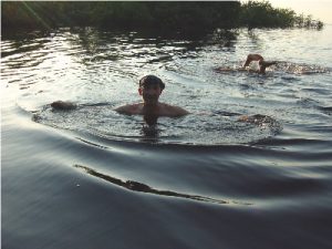
The trail more or less parallels the road, but is a far more enjoyable and easier hike. The trail cuts through the palmetto fronds beneath the live oaks and you soon lose sight of the road  or where you came from.  Watch your step because wild horses and wild hogs share the trails with you and leave their souvenirs along the way.  As plentiful as the dung was, we never saw the hogs, although the population is such that the NPS has had to institute hunts to thin the herd.  The twisted shapes of the live oak trees, the leaves filtering the sun and the limited distance visibility give the landscape along the trail a mystical and unreal quality.  You would not be in the least surprised  to see any creature from folklore stick his head around a tree and look at you .  In all likelihood, you will see the wild horses on the island.  They run free on the island at the command of Ms. Lucy Carnegie, grand dame and matriarch of the island’s Carnegie clan, as set forth in her will decades ago. At the time of the American Revolution, the live oaks were harvested for use in the sailing vessels of the day because of their great strength and resiliency.  Barrier island oak was used in the USS Constitution  and can be seen today if you visit the ship in Boston.

When you arrive at Stafford Beach camp, you can select from one of less than 20 campsites equipped  with a fire ring.  There is a common bathhouse with a cold water shower and toilets, however, any water from the area including the bath house has to be treated by boiling, filtering or chemicals before it can be consumed.  Don’ t even brush your teeth with untreated water.  Your campsite can range from extremely private to rather private depending on the proximity to the bathhouse.  A trail runs across the dunes  to the beach pictured at the top of the post.  Although the rangers sometimes drive over to check on things, the only other  people you will see on this beach are the ones who have hiked three plus miles to get there.  They are there for the same reason you are: and that is nobody’s business.

Stafford Beach campsite

We chose a campsite away from the bath house and away from the beach.  As you can see it was great.  We used the overhanging trees to suspend our supplies so the raccoons, squirrels and hogs couldn’t get into it.  Note that firewood is scarce and you may want to bring a lightweight cutting implement to reduce what you may find to fit into the fire-ring. The campsites north of Stafford Beach are primitive.  There are no bathouses and no potable water.   These campsites are also not near the beach and at least one is on the intercoastal waterway side of the island.  We haven’t made it to one of those yet, but the young couple we met came back smiling.

If you want to see the island and its history in a short amount of time, then you should take the tour.  Fifteen passenger vans leave from the ranger station at the dock twice a day to take you on the tour.  We walked the three and 1/2 miles back to the ranger station one morning to take the tour, only to learn that you have to by the tickets for the tour on the mainland before you get to the island.  Be prepared.  We walked the 7 & 1/2 half miles to Plum Orchard mansion, one of the many Carnegie  mansions on the island and then the 4 miles back to Stafford Beach.  It was worth the walk.  A volunteer working in conjunction with the Park Service was at the mansion and gave us a great talk as he showed us around.   A half mile or so south of the ranger station is the museum, housed in the Carnegie ice house and beyond that are the ruins of the main Carnegie complex, where Ms. Lucy held sway and before her the earlier claimants on this amazing island.  Ms. Lucy’s Dungeness burned in the middle of the twentieth century but you can still sense its grandeur from the ruins.

Dungeness Ruins on Cumberland Island

At the north end of the island is the church where John F. Kennedy, Jr. got married, in between is the Greyfield Inn run by the Carnegie heirs, cemeteries, wild horses and maybe a few ghosts.  Most of all it is a place to get away from it all.  I’ll have more to say in a later post.

Great Smokey Mountains Hike in Lodge – Mount Leconte

The Great Smokey Mountains National Park hosts 10 million visitors each year, making it the most visited National Park in the country.  Of those 10 million annual visitors, less than 2/10ths of 1 percent get the opportunity to spend the night in a rustic lodge inside the park on top of the third highest peak in the Appalachian Mountain RangeLeConte Lodge, built in 1925 and upgraded to present times, accommodates about 60 overnight guests per night in its rustic cabins

LeConte cabins
Two of the cabins at LeConte Lodge

and is open from mid-March to mid-November.  The lodge is accessible only on public hiking trails leading up the sides of the mountain, with the shortest being nearly 5 miles in length and climbing more than 2500 feet.  We have a group of friends who make this trek twice a year, spring and fall, some of whom have done so for over twenty years.  Here is how we do it.

Mount LeConte sits beside US 441 inside the Great Smokey Mountains National Park between Gatlinburg, Tennessee and Cherokee, North Carolina.  Our core group has seven people in it. Years ago we agreed that we would rent a cabin or chalet from one of the commercial vendors in Gatlinburg or Pigeon Forge for the night before our hike, the night we were on the mountain and the night after the hike.  Sharing the cost of the chalet is as economical as a motel room and adds the convienence of not having to load all your non-hiking gear into the cars.   Of course, at one time we simply drove to the trail head from our respective homes and went up the mountain.   Now, we meet at the chalet or a restaurant in Gatlinburg the evening before the hike, reaquaint our selves and catch up a bit over a good meal. Sometimes the dinner adds to the adventure, like the time we were leaving the parking lot for Calhoun’ Steakhouse when a black bear crossed in front of the car.  The morning of the hike we’ll usually have breakfast at the Log Cabin Pancake house and then head to the trailhead.

Although there are 5 trails to the top, we usually take Alum Cave Trail up and then take another of the trails down.   It’s  important to  have your tailgating supplies in the vehicles at the end of the hike.This requires a consensus at breakfast because we have to take part of the vehicles to the trailhead we will come down at and drive the party to the Alum Cave trailhead to start the hikc.  The trailhead for the Alum Cave Trail is directly on US 441 inside the Great Smokey Mountains National Park about 8 miles south of the park welcome center.  There are two parking lots and during the fall and spring they fill up with day hkers’ cars as well as car’s of those staying at the top. Leaving the trailhead you cross over a bridge and hike along a mountain stream for the first hour or so.   This part of the trail is green with ample foliage and if the has been plenty of water, so you will pass through a Rhodadendram Tunnel as you move along the stream

Along lower Alum Cave Trail

crossing a couple of  footbridges until the trail goes up through a hole in the mountain and climbs above the stream.  Take your time along here before you reach the vista’s at the higher elevations.  Along here, every thing there is to see is close at hand.

Alum Cave Footbridge

 Alum Cave Trail gets its name not from a cave but from a distinctive over hang about 2.5 miles up the trail.  A yellowish alum like powder flakes off the walls and covers the ground near the outcrop.  The trail gets decidedly steeper as you near Alum Cave, causing many to stop and rest.  Some  day hikers turn around at the cave and many others stop there for a snack, but the

Looking back down the trail to Alum Cave

area is so powdery that you are better of  moving on up the trail to  Inspiration point.   There a rocky outcrop where the trail crosses a ridgeline that provides ample seating and a great view of the valley below.  As you climb up the mountain the trail gets steeper and crosses the ridges with a series of lengthy  switchbacks.  At a number of locations you are moving across exposed rocks and cables have been installed to give you a hand hold since there can be a drop off immediately adjacent the trail.  The footing can be treacherous when there is rain or ice on the mountan.  Even in dry weather you can lose you footing and easily stumble on the uneven rocks.

This part of the trail can be wet or icy

The hike will take most hikers more than four hours, so remember that the weather can change drastically and that as you go up the mountain the conditions will not be the same.  We’ve encountered people suffering from hypothermia because the left the parking lot in shorts and a tee shirt and got caught in a rainstrom a couple of hours up the trail.  If you don’t have raingear, fold up a large trash can bag and stick it in your pocket.  Tie a fleece around your waist or neck, just in case. You’ll be much better off carrying a few extra ounces than having your lips and fingers turn blue.  The rangers have to recover hikers from the Great Smokey Mountain trails every year for the lack of such simple precaustions.

The trails leading up to the Lodge and beyond are public and you can make a day hike to the top and back down if you are in generally good condition.  However, If you want to overnight at the LeConte Lodge you need a reservation.  The Lodge is a privately operated facility so you need to make reservations directly with them. Typically, reservations for the following calendar year are opened up on October 1.  At that time, a sort of lottery takes place to see who gets which dates.  We always submit our requested dates by October 1.  Some years we have been shut out on the initial requests and have had to scramble for dates the came open later.  If you don’t want to stay at the lodge, you can camp between the Lodge and the through hikers shelter up near Myrtle Point.  Boulevard Trail leads from Mt. LeConte to the Appalachian Trail about 3 miles east of where the AT crosses 441 at Newfound Gap.  Although there are a number of other shelters along the AT in the area you will still find some through hikers who come over to this shelter.

The Lodge has no electricity, outdoor community toilets, no showers, a dining hall, crew quarters, a small souvenier store and community room, and cabins that can sleep from 4 to 13 people per night.  The cabins are heated by butane space heaters and contain full size bunk beds.  That is to say, two hikers top and two hikers on the bottom.  Most cabins also have at least one single cot.  When you get to the top, you can get hot chocolate to hold you over until dinner at 6:00pm.  If you include it in your reservation you can have a glass of wine with dinner.  Usually, we’ve been able to get to the cliff tops to the west of the Lodge in time for sunset.

Sunset on Moute Leconte

When the weather is right its gorgeous.  The cliffs are only a quarter mile from the Lodge so it only takes a few minutes to get there.  The picture above doesn’t do it justice.  If you dont’t make it to sunset, climb out of bed in the morning and go to Myrtle point, which is half a mile to the east and along toward the Boulevard Trail.  Don’t foget to eat breakfast though.  Its the same every time I go there and I eat it with gusto.  If you don’f feel like walking to Myrtle, sit on your porch and watch the dawn.

Dawn on Mount LeConte

It takes much less time going down than up so we don’t usually rush leaving LeConte Lodge.  We vary the trail going down and have done Bullhead, Rainbow Falls, Trillium, and Boulevard, which is probably the most scenic, but is the longest. Each is worth the walk in its own right.  You may or may not see much wildlife.  We’ve seen snakes, chipmunks, deer and almost evry trip at least one black bear.

Mother Bear on Mount LeConte

Although these creatures are under a lot of pressure from the number of visitors to the park, they are still wild so keep your distance. Head back down the trail and look at the faces of the people near the bottom who will turn back before they reach the summit and enjoy your accomplishment.  Happy trails.

Hut to Hut Hiking in the White Mountains

We had backpacked our way into and out of the Grand Canyon, and hiked along the Highline Trail to Granite Park Chalet in Glacier National Park, so we were looking for a little something different along the Appalachian Trail.  It turns out that the Appalachian Trail Club maintains a series of Huts along the AT.  The huts we decided to go to were in the White Mountains of New Hampshire along the Southern Presidential Range.  Of course, getting there was half the fun.  We were scheduled to fly into Portland, Maine, but the pilot couldn’t get the plane on the ground and had to divert to Manchester from where we took a bus to Portland.   Needless to say, we arrived about 3 hours later than expected.  We were driving a rental over to Conway and spending the night in a Bed and Breakfast before heading up to ATC Lodge, however, we had no illusions that the doors of the B&B would be open after midnight, so we called ahead to the Bernerhof Inn and told them we’d be late.  They left a key outside in a secure place for us and we let ourselves in to the house in the middle of the night.   We met our hosts the next morning and were very grateful.  There are nice people all over the world and these innkeepers are some of the nicest. 

The next morning we went for a local hike to a state park near Conway, then headed up to the ATC Lodge to meet our group.  Early the next morning we crossed the road and headed up the access trail to the AT.  Look and the picture and tell me that access trail doesn’t look like a land slide

The Amazon River: Getting wet

The Amazon River lodge where we stayed caters to an international clientele.  In the open boat that we used to get around in, our group of travelers included a 20 year old British girl seeing the world on her own, a German couple, myself and two sisters, a young man from New Jersey, and three Italian young men.  Guiding the boat with the handle of the outboard motor was our Brazilian guide, Jorge, and his young assistant.  The common language was English so we had no trouble understanding at least the words.   Jorge ferried us along tree  lined passages, through grass meadows growing in the water until we reached the open water just below the tower room that the girls and I stayed in. Heading up stream he came to a small town: a mission, a store and some houses.  Along the banks, cows and pigs stood ankle deep in the water.   Jorge  explained that occasionally, one would fall victim to the teeth of the river, but, they had to drink.  The people who lived there dressed no differently than people you might see in any rural area.  In fact when we got out of the boat and walked along the trails through the rain forest, it looked amazing like the Southern US, except the trees seemed taller.

We then took in a ceremonial dance at another village.  The villagers pulled the front of the boat up out of the water and invited us through the thatch hut village to a lodge.  Along the way, they pointed out a snake skin stretched out on a split log. The skin was easily 18 inches wide and 14 feet long.  Apparently, the predator had been caught feasting on a domesticated pig.  Inside the lodge the dim light revealed several young Brazilian men and women in what passed for tribal garb: loin cloth, bare breasts, and feathers in their ample hair.   We tourists were seated around the periphery of the lodge while the ritual dance was performed.  Then they invited some of us to join in.  Of course, I did.

Piling back into the boat,  Jorge asked if we wanted to go to the beach.  Laughingly, we affirmed that we did.  He turned the engine up and headed back downstream to a cove with a sandy bank that looked very much like the place where we had fished for piranhas.  He said he could put us out on the beach or we could swim to shore.  No one seemed enthused about going ashore.  Then he said that we could swim from the boat, but not to get into the water if we had any cuts or scrapes that might bleed.  About that time, his assistant dove overboard.  I told the sisters that if it was ok for him, then I was going to go in as well.  The Italian guys heard this and laughed saying “No guts, Mr. Brave American!”  Since they had called my bluff, I had no choice, so stripping off my shirt and handing my glasses to the girls, I slipped over the side into the dark waters of the Amazon and swam away from the boat.   It was a little disconcerting, but I looked back at

our Italian friends and said: “Your turn.”   They stayed in the boat, but the German guy and the kid from New Jersey jumped in as well.  I’d had my fill of the foolishness pretty soon and pulled myself over the side of the boat with more than just a little relief.  The others followed close behind and the Italians just muttered: “Crazy.”

The Mayan Calendar and doomsday

The Mayan Calendar is said to be nearing the end of a “long count”, which is believed by some to signal an apocalyptic change.  On one of our trips to the Riviera Maya, we visited Chichen Itza which contains the ruins of a city from over 1500 years ago.  While the Europeans were suffering through the Dark Ages, along the Yucatan Penisula and across Mexico a civilization was flurishing that had incredible astronomical knowledge.  For example, at Chichen Itza you can see a four sided pyramid that has 365 levels from top to bottom.  Known as the  Pyramid of Kukulcan, this remnent from the lost civilization is laid out such that two of its edges have carved serpents heads on the lowest level.  On the Spring and Fall equinox, the shadows of the pyramid levels falling on one another along the edges form the shadowy body of the serpent coming down the pyramid and the ending at the sculptured head.   If you go back to the long count on the Mayan Calendar, a recent explanation helped understand what the long count relates to: when the earth in its transit crosses the mid-pooint of a glactic or universal divide. Apparently it does this every 5,800 years.  So, how did the Mayans know this?  Or is this just coincidence explained by science? 

At any rate, this year might be a good time to take that Vacation to Cancun or Puerto Morales and run down the road to Chichen Itza. If you do, plan for a full day and then you won’t see it all.  In addition to the  Pyramid of Kukulcan, there is also an ancient stadium at which the teams competed for honor in a deadly game resembling Lacrosse.  Within walking distance is an observatory housing and Cenotes in which cerimonial sacrifices were made.  I’ll come back and write about these on another day.

Backpacking Grandview Trail into the Grand Canyon

A backpacker’s life is probably not complete without a trip to the Grand  Canyon.  We decided against Bright Angel Trail which heads down from the south rim a the lodge and main tourist area, but, we didn’t really want to take off into the Canyon alone. The solution was REI.  http://www.rei.com/  We had gotten most of our backpacking gear, technical clothes, backpacks, and cycling supplies from REI so as members we get their promotional mailers and emails.  We were hooked on the 3 day backpacking in the Grand Canyon as soon as we saw it.  REI proovided the tents, food, and two  guides Tom and Todd who met us at the campground at the south rim.  After dividing the gear to be carried and assigning us tents, they prepared the first of our amazing meals and told us to hit the sack because we were starting down early the next day. 

And so we did, heading off into the Canyon at Grandview  point down the Grandview trail.  The first few miles were a continuous downhill with switch backs, amazing views and incessant chatter from the excitement.  The first goal was Horseshoe Mesa that we were looking down on and as an added bonus, a cave in the side of the mesa.  We reached the Mesa in a few hours and numerous cut backs.  The trail further down into the the Grand Canyon passes the remnants of a house and storage area and bears off to the east.  A less distinct trail heads off to the west then turns south down to the edge of the mesa.  A narrow trail leads around to a shelf where double entrances to the cave are set back from the cliff face.  Inside the cave is a log, presumably so that if you don’t come back to the entrance, they’ll at least know where you wound up.  Leaving the cave, we headed back across Horsehoe Mesa and drop down 800 feet through the Redwall Limestone.  Well,  it feels like you are going to drop. The problem is your backpack rubs against the wall and urges toward the  empty air that is only inches away from where your feet are trying to land.  Don’t let anybody tell you going uphill is harder.  Going down a trail like this is far more exhausting.

The Amazon-Swimming with Piranhas

One of my goals was to see at least one great river on each continent. I had seen the Mississippi several times, so the next closest was the Amazon. The Amazon basin is vast, with two rivers joining at Manaus, Brazil to form the combined Amazon River that empties one third of the earth’s fresh water into the Atlantic Ocean.  Manaus is roughly one thousand miles from the coast.  We flew into Mansus and took a river boat upstream along the Rio Negro to the Ariau Towers. You can find their site at http://www.ariauamazontowers.com/.  If you visit the site you will see that we weren’t really roughing it, nevertheless, it was an amazing adventure.  We had a room in a tower located about 3/4 mile away from the main complex, where the food, medical and small store was located.  To reach the room we walked our luggage along an elevated wooden board walk, that had two levels: one for the dry season and one for the wet.  We were on the upper level so part of the time there was water below us.  The room was spacious with a queen bed and a twin bed and private toilet and shower.  There was another room below us but we never saw the occupants.  A screened porch gave a rocking chair view forty some odd feet above the jungle floor. 

We met our guide Jorge back at the main building along the dock where he directed us and about 8 others into an open boat with a outboard on the back.  We headed out onto a river so wide you could barely make out the other side. Half an hour later, Jorge eased the boat into an open area among some tree tops and we picked up our poles, literally ten foot long tree tops that had a t of monofilament attached, a steel leader at the end of the mono-filament and a hook at the end of the leader.  Jorge had a supply of bloody beef cubes about the size of the end of your little finger with which we baited the hooks.  Jorge watched with amusement as we dropped the hooks into the water and nothing happened. ” You have to make some noise.  Splash the water with the ends of your poles.”  Then he said to pull up the poles.  All the bait was gone.  He said that there were so many of the fish and their teeth so shaarp that you had to be very sensitive to feel them bite and then set the hook.  We re-baited and Jorge pulled in a Piranha.  I pulled in the next one.

The fish were not very big, but the teeth  looked as big as the teeth on a carpenter’s saw.  Jorge and I caught a couple more and it was time to go.  Jorge said we could swim in the river downstream if we liked, but, not to get into the water if you had an open wound or scrape because the blood would attract the fish.  We ate the fish for dinner and defered the swim until the next day.

Hiking the Isle de Capri

Seer had always talked about going to Capri, but neither of us are shoppers. We checked the island off the coast of Italy out and decided it would be a fabulous place to spend a few days hiking. No backpacks or camping, instead we would find a hotel and explore the island on foot. At the east end of the Island is the Villa Jovis, ruins of an ancient Roman party palace. Rising more than 2000 feet in the center of the island is Mt. Solara. We figured we could stay in between and easily hike to both.We booked airline tickets using frequent flyer miles so the story of getting there is where we’ll start.

We had a layover in Philadephia before the alnight flight to Milan. I know Capri is off the coast from Naples. We had to fly from Milan to Naples on a AirOne, a regional airline. If you ever go to Milan, follow the herd getting off the airplane. We were supposed to pick up our boarding passes for AirOne in the airport. Getting off the plane the signs said Baggage Claim and connecting gates. We only had carryon items so we didn’t need baggage claim. Granted, the hallway to baggage claim was lit and the hallway to connecting gates was dark, but there were a couple of uniformed guards by the access, so as everyone else headed toward baggage claim, we walked over to the guards and explained that we needed to get our tickets at AirOne. He didn’t know what  we were talking about, but after looking over the itenerary in my hand, he let us through a turnstile to a hallway and stairway that lead to a large waiting area adjacent the duty free shop. Spotting the information desk, we confidently asked for directions. The maid who was cleaning up told me the staff would arrive in half an hour, so we could take a seat. When, the next attendant arrived, She looked at us as if we had extra heads and informed us, she did not know of any AirOne, but we could ask the ticket agents at the kioks at the gates. Note that we had not gone through customs, had not shown our passports to any one and were wandering around an Italian airport with no clue as to where to get our tickets for the next flight.

Cycling Vermont

Seer and I, along with two sisters, decided to combine cycling, travel and the fall foliage of Vermont.  We didn’t want to ship the cycling bikes so we contacted POMG Bike Tours of Vermont at  http://www.pomgbike.com/ and arranged everything except the airline tickets.  We went in October and the foliage was amazing.  The cycling bikes Rich and Jenny provided were in great shape and had toe clips, although you probably would want to take your own pedals and clip system as well as your own  seat.  Rich rode with us and Jenny drove the SAG truck as needed. Our accommodations were in Stowe, so that was our starting point, dinner and rest destination each day.  I’m not sure what hills we climbed but Rich called them Ekk and Oh, My God.  They weren’t really difficult and didn’t really require cross-training, aka walking the bike up the hill, but we were assured that the LAMB gaps trek would test your cycling mettle.   Over dinner we discussed that more challenging route and an alternative where only two of the gaps per day were ridden. I think Rich  called it the LAMB Chop.

More to come