Ponies, bikes, trails, and the Virginia Creeper

Along the Virginia – North Carolina border, near the little town of Damascus, a section of the Appalachian Trail runs out of town over the mountains and through Grayson Highlands State Park.  Damascus itself is noteworthy as a resupply station for the Appalachian Trail through hikers.  Grayson Highland is an amazing state park with great camping facilities set in a remote setting not too far from I-81. In between the two of them, you’ll find the Virgina Creeper, or maybe you’ll go to do the Creeper and explore Damascus or Grayson Highlands.  Either way, give yourself a couple of days in the area to soak it all in.

You can start your hike on the Appalachian Trail approach trail inside Grayson Highland and head up to Mt. Rogers if you are a peak bagger.  Mt.  Rogers is the highest peak in Virginia and is only few miles away from the parking lot in Grayson Highlands.  Expect to see the wild ponies along the way.

The wild ponies in Grayson Highlands State Park.

From the photo above, you might not guess it, but we were on the trail in August.  The temperature was in the mid 60’s and there was a dense fog most of the day.  A hurricane had moved up the east coast and although it wasn’t directly affecting our weather, we felt that it was.  It also has something to do with the park being at about 4,000 feet above sea level.  The horses are quite used to people and came right up to us as if to beg for a snack or to be  petted.  We gave them no snack but we did rub their backs and scratched their ears a bit.  The hike was easy to moderate, however, since we were in the fog and uncertain about sundown we did not make it all the way to Mt. Rogers.  Be sure to carry an accurate map and compass as the area between the parking lot is criss crossed with horse trails for riders and hiking trails with somewhat confusing markings.  We did alright but we went out of our way on the return trip when we consulted with another group as to which way they had come.  I can’t attest to the vistas because of our cloud cover, however, the area was largely a bald or meadow area, thus on a clear day you would have undoubtedly had a great view.

The campground at GHSP is a great car camper park with a variety of sites that can be reserved in advance to suit your camping needs including running water and electricity, or, you may elect a site that does not have electricity.  It is a family friendly camping area, where one little boy ran up to us excitedly as we drove in, only to be disappointed when we told him there were no children with us.  It is east of Damascus by about 30 miles and will take you the better part of an hour to get there. There is a camp store and bathhouses as shown in the link.  You may want to consider checking out the Mount Rogers National Recreation area for some camping in a little less crowded area.  The Beartree Recreation Area campground has primitive sites without hookups.  Hurricane Campground has sites with tent pads and fire rings.

Along side the road between Damascus and the park, and in fact from Abington, Virginia adjacent Interstate 81 into Damascus and beyond for about 17 miles is the famous Virginia Creeper Trail.  Total length of the trail is about 34 miles.  We had decided that we would ride the Creeper’s eastern end, downhill from White Top to Damascus on our way home from camping and hiking, but we hadn’t brought bicycles with us.  So we stopped along side the road at a rental shop and picked out a couple of mountain bikes to make the ride.  An ordinary hybrid would do fine as the trail is well packed cinder that follows the old railroad track at a grade of less than about 7% all the way into Damascus.  We budgeted two hours for the 17 miles since we consider our selves experienced cyclists on our road bikes and hybrids.  What we didn’t count on was the peaceful beautiful scenery and the glimpse of the past you’ll encounter on this mellow ride.

Virginia Creeper Trestle
Beneath the Trestle

Because the trail was built for use by steam powered trains trestles were used to eliminate the ups and downs of the valleys and hollows.  Stepping to the side of the trail, you will be pleased to see how well maintained the trestles are and will be amazed at the work and ingenuity that went into building the trail decades ago.

trestle top

Don’t limit yourself to two hours on this trial.  Take a couple days and take your time.  You’ll find plenty to see, an ice cream store or two, sandwich shops and other “creature comforts” along the way.  Best of all, find an older local to talk to.  The lady that rented us the bikes we used had lived beside the Creeper all her life.  She told us things to look for, like the place she went skinning dipping 65 years ago, that you would never look for on your own.  Enjoy.

,
 

Tampa: Beach Camping Oasis 10 minutes from Town

We’ve previously posted articles about backpacking on Cumberland Island, but this post is for those of you who are looking for a great beach campground for car campers.  You’ll find it at Fort  De Soto Park near Tampa, Florida.  According to one of the Rangers we spoke to at the campground, twenty-five years ago Tampa Bay was a polluted mess and the area around Mullet Key on which Fort De Soto  is located had brackish backwater that couldn’t circulate and a dying grassy area  in the bay that soured and smelled, particularly in the summer months.  Cooperation between local, state, and federal agencies and the local conservation groups cleaned up the bay, cut new channels for water flow through and around Mullet Key and today the area is a haven for campers.

The island is reachable by a bridge from the Bayway or by water, but what will strike you is the fact that it has remained largely undeveloped.

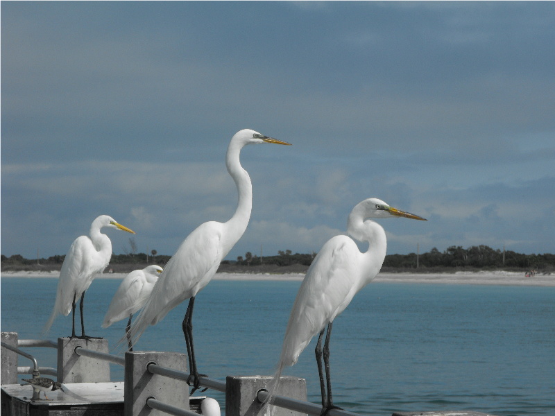
Birds on the public pier looking at the beach

If you look at the background in the picture above you will see the stretch of beach running from the Bay Pier up to North Beach.  Note that there is not a single highrise nor even a house on the beach.  If you go south from this point, you’ll enter the Bay pass the Bay pier and reach the tip of the island passing only the Park Headquarters building, restrooms and park concessions.  That is to say, other than the buildings necessary to provide services to the visitors, there are no other buildings on this island.  As you skid through Tampa on I-275, you will not believe you are going to a place as tranquil as this.

Fort De Soto Park Campground sits directly adjacent Anderson Boulevard, so it cannot be missed in terms of passing it by, but it might be missed in terms of getting a reservation.  Reservations are taken 6 months in advance, unless you are a Pinellas County resident in which case you get an extra month.    The campground holds back 10% of its 250 campsites for walk-ins.  On the weekend, a walk-in can reserve a campsite for two nights.   We asked the Ranger at check in about this and when one should arrive to be certain of a campsite.  He said that the Ranger office opens at 7 a.m. , but that walk-ins would often arrive as early as 1:30 a.m. and bring their lawn chairs to sit outside the door.  We checked this story out and on the Friday morning we were there, a person arriving at 2:00 a.m. would have been 5th in line!

The campground is laid out in three sections, a pet area for those camping pet owners who bring their pets along on their adventures and two other area’s across a short bridge over a man-made channel.  The area to the right is primarily for RV‘s and large trailers while the area to the left is primarily for tents and smaller trailers.  Campsites 1 to 85 are in this area, campsites 86 to 164 are in the pet area and campsites 165 yo 233 are in the larger RV area.

At campsite 20 looking past the tent to the water

We’ve camped  in campsites 1 and 20 which are both on the water facing out to the bay.  As you can see from the picture above the campsites are laid out on a shell base to show you the area in which you should pitch your tent or park your RV.  What you can’t see in this picture is that each has electrical service and water service, a grill, a picnic table, potable running water at a tap, and a hook on which to hang your lantern.  A small camp store with a spacious deck for relaxation has most of the supplies you might need, if you don’t want to venture back into town. Each spacious campsite is separated from the adjacent campsites by a border of palmetto bushes and palm trees so each has a sense of privacy.  However, if you are not in the pet area you will have visitors.

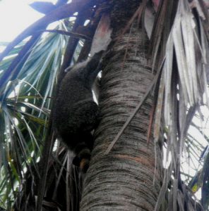
racoon at our campsite

It is no surprise to see raccoons in the day or night, so be sure your food is properly stowed  and your trash is properly disposed of in the receptacles provided. The weighted lids are more than a raccoon can lift to get into the bins, and these are not little raccoons.  The ones strolling through our campsite would easily have weighted 15 pounds.  You’ll also be visited by squirrels and birds, but clearly the largest and boldest of the visitors will be the ring-tailed bandits.   As you can see at the right, they are easily frightened and will scurry away or climb a tree as soon as you get near, however, if you are not around they will go through everything you have that’s not tied down.

Campsites 1 to 48, 138 to 153, and 202 to 232 are all on the water facing generally to the west, although many of these have a hedge of bushes between them and the water, however, a large grassy border extends from the campsites to the water.  It makes a great spot to set up your lawn chair late in the afternoon and watch the sunset.

Sunset at campsite 20

In the picture above, you see the sun setting over the other end of the island, which is L shaped, so on the other side of the trees, the sun is settling into the Gulf fo Mexico just beyond the beach.

As mentioned above, there are no developments on the beach.  However, Fort De Soto was built in the early years after the Spanish-American war between 1900 and 1910 and remains substantially intact.  The fort was rendered obsolete by the development  of mobile modern artillery and so the military closed it between WWI and WWII.  None of the governmental entities nor developers had any interest in the island in the 40’s and 50’s and the island was largely managed as a bird sanctuary.

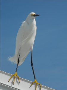
He owns the Island

Today, thousands of birds can been seen and are still protected on the island, therefore, a large part of the island is off-limits as a nesting area, however, the undeveloped beach is therefore somewhat secluded from the central road and bike path and relatively unspoiled.  The beach is widest and most usable from the Gulf pier (fishing is free with no permit required) up to the bird sanctuary at North Beach and above North Beach to the tip of the island.  The beach extends southward beyond the fort and around the bend in the island past the Bay pier to east beach.  At East Beach and North Beach, parking, pavilions and bath houses are supplied in abundance and are well maintained and clean.  The cycling trail runs the length of the island and connects to a multiuse trail that runs along South Pinellas Bayway for several miles.   You can pedal your hybrid or cruise bike along the path for miles without seeing a hill.  The road cyclist zoom past in their spandex on the road, generally disdaining the multiuse path and its slower traffic.

The island and the campground make up one of the better family camping locales on any beach anywhere.  It’s also quite attractive to the RV crowd.   Camp cleanliness and light maintenance is the responsibility of about 8 couples who serve as camp hosts.  They get their campsite free of charge for three months in exchange for 20 hours per week (per person) spent “doing the chores” that are necessary to keep the camp pristine.  A husband and wife team, who were one of the host couples we spoke with, had been on the waiting list to host at Fort De Soto for three years and were thrilled to have finally arrived for their three month stay.  The Rangers we talked to had all been with the park for at least a dozen years and many of the campers had returned for year after year to the park.  One Pinellas county resident shows up at 2 a.m. on Friday nearly every week to get a walk in campsite so he can spend his weekend fishing and communing with nature.

Arrowhead Picnic Area

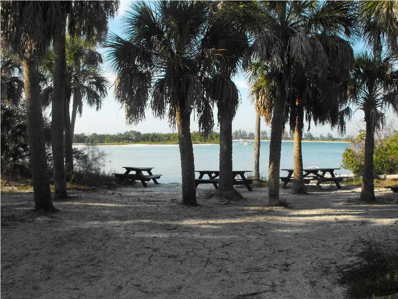
Separate from the campground, on the north end of the island across from the pavilions and bath houses servicing north beach, a narrow road leads to Arrowhead picnic area.  Again, the seclusion and sense of being out in a wilderness is amazing. The area is as well kept as the remainder of the park with trash cans, bath houses, and picnic tables available for day users.  No overnight camping is allowed in this areas.  You may want to just go sit there and rest by the water, or maybe you’ll rent a kayak and paddle up to here on your way to adjacent Shell island, which is also undeveloped and reachable only by boat.  Either way you’ll find it a tranquil and restful spot.

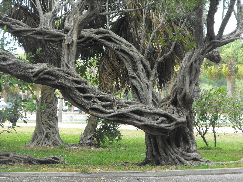
This place is one of our favorite car camping locales.  It’s clear we aren’t alone in thinking this.  One of the rangers told us that about 10 to 15% of the winter visitors are French Canadians.  One couple we met were from California, another from Maine, another lady from Pennsylvania.  There was a good mix of families with kids on bikes, retiree’s in RV’s, couples hanging out together, minding their own business but happy to wave or converse if you wanted.  You can see more about the campground at http://www.pinellascounty.org/park/05_ft_desoto.htm .   There may be additional posts regarding Fort De Soto on Goneguru.com, however, for one last look at the kind of scenery you’ll find at Fort De Soto State Park, here’s a tree that has been there a long, long time.

Inside the campground at Fort De Soto Park.