Coeur d’Alene and Ironman Triathalon, too!

Coeur d’Alene, Idaho, USA (June 2012)   Near this tree on the banks of Lake Coeur d’Alene is a commemorative sign telling of the Native Americans who once gathered on the shores of the beautiful lake in northern Idaho.   After the Europeans came to America and made their way westward,
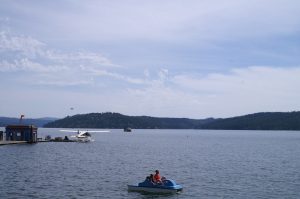
On the shores of Lake Coeur d’Alene

and the great railroads were built, Couer d’Alene took its spot among the beautiful hideaways of the west.  Easily accessible from the Spokane, Washington airport via I-90, Couer d’Alene presents a marked contrast with the sprawling and industrial Spokane.  The centerpiece remains the lake with its clear water surrounded by the green hills, but the town of Coeur d’Alene has done a lot to make the visitor welcome.
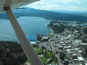
Lake Coeur d’Alene

The visitors have come and some with star quality names  have built homes in the area that we will only read about or fly over and look down on their pools and tennis courts and guest houses.

Along the lake the town proper is a mixture of shops and homes, where walking into the shops gave the impression that the shopkeeper was genuinely pleased to have you in the store, rather than the department store “I just work here” stare.  Walking to get about was clearly no problem and a pleasant hike around Tubbs Park will relieve the stress and provide you with some spectacular views of the lake.  We will return to Coeur d’Alene for its beauty and charm, and will come back to take our road bikes on the nearby Trail of Coeur d’Alenes  rails to trails project nearly spans the Idaho panhandle.  But, on this trip we were not brought to the town by any of these.

This trip we came to Coeur d’Alene for the Ironman Triathalon.  An Ironman Triathlon is not for everyone.  In fact it is only for the fittest of the fit.  Ironman competition began in Hawaii more than 25 years ago when several highly fit military men came up with their ultimate test based on swimming, cycling and running events in which they had participated.   The challenge they set for themselves was an open water swim covering 2.4 miles, a bicycle ride of 112 miles, and a marathon run, all in one day.  From a handful of participants on  that day the Ironman has grown into a world wide franchise, with thousands of participants testing themselves in Ironman sponsored events all over the world.  We have an Ironman finisher in our family, so we came to watch him participate, see Coeur d’Alene for the first time, and take a side trip to Banff.

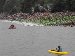
The first leg of the contest is the swim.  The men and women in their wetsuits lined up along the beach shown in the photo below to dash into the 57 degree F.  water where they would swim away from shore 0.6 miles, parallel the shore 0.2 miles, and back to shore where they would re-enter the water and do it again!

The start is awesome.  You might see 25 or 30 professionals start half an hour before the age classified amateur participants and it is inspiring to see the pro’s go at it, but the big rush is when the 2500 hit the water at the same time!

Coeur d’Alene swim start

Although it is a difficult spectator sport, as you can see thousands of supporters for the athletes were en masse near the beach and along the seawall yelling and urging their favorite participant on.  The water sorts the athletes out by their ability, with swimmers straining stroke after stroke to finish the 2.4 miles before the two and one half hour time limit expires.  Then, they run across the sand to the the transition area where they are helped out of their wetsuits, into warming rooms if they need them, and onto their bicycles.  Some are unable to continue beyond the swim.

The bike ride is 112 miles.  For this part of the race,  a lane of US 95 heading south from Coeur d’Alene and major streets in town were closed to trafffic.  It is along the streets that you will get the best views of the cyclists.
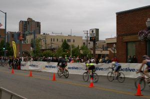
Ironman Tri-athalon cyclists

Although, the bike ride is also two laps, the laps go so far out of town that each athlete is out of sight for hours, so for a spectator there is plenty of time to grab a bite to eat, see the sights, and get ready for the next time your athlete speeds by.  Some say the smart ones take a nap.  We chose to walk around the world’s largest floating boardwalk adjacent the Coeur d’Alene Resort.  The boardwalk is 3300 feet long and surrounds the marina.  If you look at the boats tied up in the Marina, you’ll understand that quite a bit of money is spent on the enjoyment of Lake Coeur d’Alene.
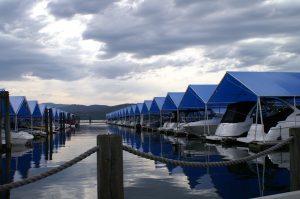
Looking at the Marina from the Boardwalk

We also took in some of the shops and a couple of miles of trails in Tubbs park before it was time for the marathon part of the competition.

The marathon is grueling.  Even the fastest finisher has to run part of his marathon in the heat of the day.  26 + miles in two laps through the city streets of Coeur d’Alene.  Although we cheered the athletes on, there is no team in this sport. Each athlete is on his own, testing his or her own willpower to put one foot in front of another.
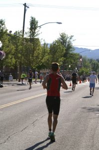
Punishing afternoon sun

Now they are faced with the final deadline: Be across the finish line by midnight or you are not deemed to have finished the race at all.  For some, what started filled with adrenalin at 7:30 in the morning will end in anguish after midnight.  But for most, they will hear the crowd cheer and give high-fives as they near the finish line.
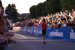
The Finish

The finishers are checked by medical personnel, wrapped in thermal reflectors to keep their bodies warm as walk around with family and friends or head to their bed.  Many come back to near the finish line or sit where they can hear the music playing and hear the announcer give voice to the name of each finisher.  Deep into the night the music plays and the names are called out. Then, at midnight, the music stops, no more names are called, and the crowd leaves.   What seemed forever to train for and watch is suddenly over, but the Ironman finisher has a memory and medal that should last a lifetime.
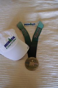
Ironman Finisher’s medal

Monkeying around in the Amazon River Basin

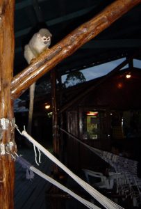
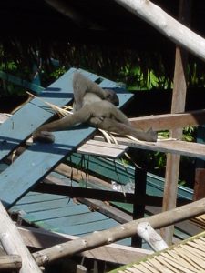
You might expect to see some wildlife on a trip along the Amazon River and you will not be disappointed.  The most prevalent mammals you will see are the monkeys and you will see them when you least expect it, therefore, the pictures of the monkeys you’ll see in this post are not high quality poses of monkeys panning for the camera, but rather, candid shots of the little guys doing what they do.  Steal.

Watching the humans in the hammocks below

Of course, they are just like any other creature that lives near humans: if the human is going to leave something laying around, then obviously the human doesn’t need it or perhaps thinks the passing monkey needs it more.  This is particularly true of food so precautions are  made to keep them away from your food, but, they are industrious and clever and if you turn your head you make look back to learn you are sharing your plate.

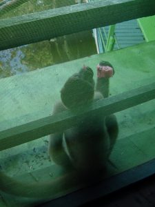
A little thief enjoying his melon

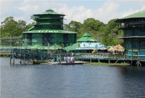
If you were lounging in the hammocks, you’d best not fall asleep with anything in your hand, for when you wake up you can be assured that the little guy watching you will have investigated and taken what you had if it suits your fancy.  They were incredibly quick at getting around the screen enclosures and grabbing a piece of fruit or other food then settling down on the other side of the screen to enjoy their treat.  If you have read the other Amazon posts on this website you will know that we were at the Ariau Towers on the Rio Negro tributary of the Amazon River.   This complex has a main building in which the dining hall is located adjacent the boat dock.   This is the building to the far right in the picture below. As small store and hotel type rooms were adjacent also.  If you look at the picture below you will notice the plank catwalks leading to the left in the picture. To get to our room, we walked about a half mile into the jungle on one of the these catwalks.

Ariau main complex
Sleeping monkey

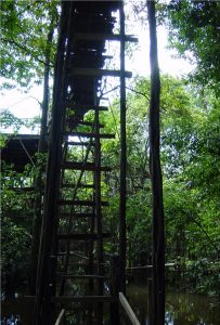
As you may notice, the catwalks were at different heights.  Further, they branched out into different directions.  One day we were taking an alternate route to our room when we came upon a stair where we had to go up to the upper catwalk.  Asleep on  the stair well was a little was a little monkey like the one shown below.  As I started up the stair, I reached down with my hand as if to say “stay where you are” but before I could say don’t, he reached up, grabbed
my hand and was instantly perched on my shoulders.  Now , perhaps I should have expected it, but I didn’t expect the utter lack of sympathy I received from my companions, who immediately started laughing at my predicament.  There I stand, nearly half a mile from the main buildings with a wild Brazilian monkey perched on my neck.  Not wanting to alarm or anger him, I reached gingerly up and touched him which only caused him to hold on tighter and begin chattering, which indicated to me I should leave him alone.

Upper catwalk

So, I continued up the stairs and walked along the catwalk toward our room.  He was perfectly content.  I was wondering whether I’d wind up with monkey poop down my collar, and my sisters were laughing hysterically.  In a short while, that seemed incredibly long to me, I started to cross over a stream and my rider decided that was as far as he wanted to go.  He hoped off, ran back down the catwalk, causing the two sisters to nearly fall off as the scurried to avoid him, and was seen no more.

We crossed the stream and were soon at the tower housing our room.  Gratefully, I went inside, washed my neck, and prepared my self a beverage.  Then I retreated into the safety of our screened in balcony and sat and laughed.   Moral of the story is: Never offer your hand to a monkey that you don’t want on your back.

The view from our balcony.

Although we laugh about the monkey, he was not the only encounter with the wild we had on the board walk.  We managed to disturb a  little green snake and wound up with him on the boardwalk with two of us going in one direction and the other behind him saying don’t leave me here.  He quickly escaped and we were certain to watch our step from then on.   Let me know what you see when you go.

Hiking Capri: From Marina Grande to the top of Mt. Solora

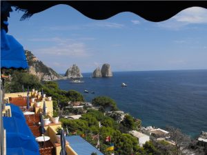
Our Italian hiking trip to Capri found us staying on the southern side of the Island at Marina Piccola.  Although there are many fine hotels in the town of Capri, which sits astride the middle of the Isle de  Capri, we chose to stay at the Hotel Ambassador Weber, mainly because it was right on the sea, which I prefer and because it was reasonably priced.  Our window did indeed look over the sea, the beach below, to our left the Faraglioni and to our right the cliffs rising up to Mt. Solora.

The view from the Ambassador Weber

The staff at the hotel were very friendly and always tried to help, even pointing out trails along the map of Capri that they provided, however, when we told them that we wanted to walk up  La Scala Fenicia, the concierge looked at us with dismay and exclaimed, “Oh no, it is very tiresome. You do not wish to do this!”   We persuaded him that we did indeed want to go see the staircase, but we did not tell him that we intended to go all the way to the top of  Mt. Solora, so he directed us to the other side of the Isle de Capri to Marina Grande, where the staircase begins a few feet above sea level.

To get to Marina Grande from Marina Piccola, we walked up a brick pathway to Capri and then took the funicular railway, an inclined railway running between Capri ad Marina Grande.  If you go to the Isle de Capri, your trip is not complete without riding it.  From the Funicular we walked past the beach and docks up the road to the west of

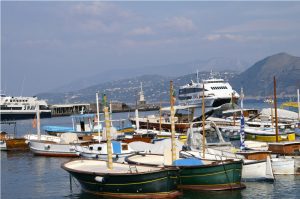
Boats at Marina Grande

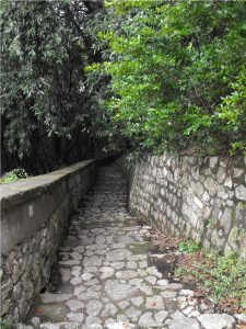
the fishing boats, then turned south with the street until we came to a small sign near the Church of St. Constanza marking the bottom of  La Scala Fenicia.   The staircase has approxiamtely 900 steps cut into the granite from the port to the town of Anacapri.  For centuries, this staircase was the only way to get from the port to Anacapri.  Although the name implies that the steps were cut by the Phonecians, they are likely to have been hewn by the Greek settlers of the island instead.

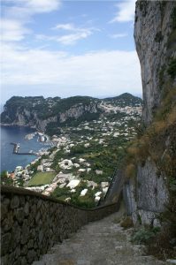
The climb takes you past the residences, school, and olive gardens and fields. As you look back down the steps, the fishing boats in the marina grow increasingly smaller and the climb becomes steeper and steeper.  You look up to see where the staircase may come out and wonder if you can get there.  Eventually the trail crosses the modern road to AnaCapri, and as you walk from beneath the roadway people look at you as though you were insane. It is probably the fact that  your mouth is hanging open gasping for air.   Above the road the steps continue, and the panorama below you grows ever larger until you come to Villa San Michelle, built by Axel Munthe and now a museum.  There, you find yourself on a street passing little shops and leading into Anacapri.

La Scala Fenicia above the road  

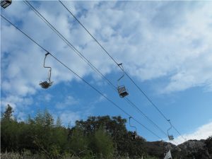
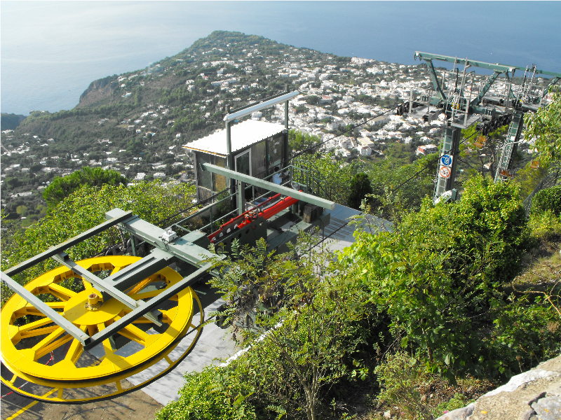
We walked through the town and found our way to the Church of St. Michele.  The floor of the church is a hand painted tile depicting the explusion of Adam and Eve from the Garden of Eden.  Walkways around the floor preserve its beauty and  allow you to see it up close, but you won’t appreciate it until you climb the staircase and look down from the galleries above.   We returned to the center of town and debated taking the chair lift to the top of Mt. Solora.  However, we decided to walk instead, so we cut across the village to the east of the cable line and soon picked up the trail.  It was a moderate hike through a pine thicket so that you only saw the cable cars passing overhead occassionally.

The cable Cars to Mt. Solora

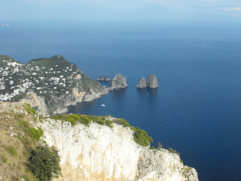
After about an hour, we had passed the spur leading down to the  Hermitage of Cetrella and were making our way to the summit of Mt. Solora.  As with most of the island, here you find the ruins of by gone battlements and outbuildings, in a setting so picturesque as to defy imagination.  Looking down to the east we can see the Faraglioni east and south

Faraglioni from atop Mt. Solora

of Marina Picolla.  Jutting out at the far eastern point of the island is Villa Jovis, with Capri and Anacapri on either side of the island. The sea below is a multi-color pallet

Anacapri from atop Mt. Solora

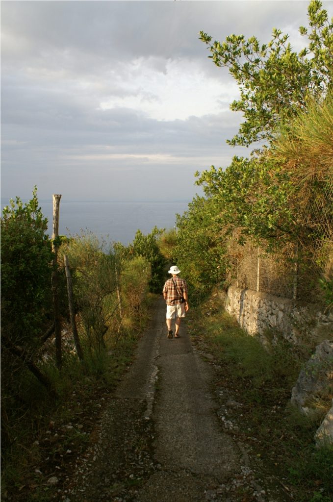
and you wish not to leave, but the small cafe is closing and it is clear that they want everyone to leave.  The few tourists, besides ourselves, and the cafe staff board the cable cars and head down while we return to the path and hike our way down to AnaCapri, where we catch the bus back to Marina Picolla.  It was a great day.

Hiking the White Mountains: Hut to Hut

Hiking the Southern Presidential Range of the White Mountains along the Appalachian Trail  is a test for an outdoor adventurer of any level.  The mountains are beautiful, but the layer of soil over the granite building blocks of the mountains is extremely thin and you will find yourself walking on, over and around areas of exposed rock throughout the hike.  That should not dissuade you from the hike, however, since in our group were people in their early twenties and mid-seventies.  Each handled the rigors of the hike and finished with smiles.  We met at the AMC Highlands Center  at Crawford Notch in northern New Hampshire and followed a well marked trail that crossed the road  and lead us up the mountain to  the AT.  There are stretches along this hiking trail  where you will believe it was designed for goats. 

The access trail from Crawford Notch to the AT

Note that the Highland Center is at 1900 feet above sea level. In a few hours or so you’ll reach the AT and from there on you follow the ridges and flanks of the mountains.  It was on this hike that we learned the meaning of the term “peak bagging.”  During our first night on the trail, at a hut named Mitzpah Spring Hut, one of the AMC hut workers  gave a seminar on the subject.  At first I thought he was saying Peat Bagging, then he explained that peak bagging entailed reaching the summit of a named mountain rising at least  4000 feet above sea level (asl).  Mitzpah Spring Hut sits at 3800 feet asl  on the south flank of Mt. Pierce.   To get to Mitzpah Spring, we scrambled up the access trail to the summit of Mt. Webster where we picked up the AT and headed north, summitting  Mt. Jackson before getting there.  So we had  “bagged” our first peak on this hike before we even knew what the term meant.  The “hut” sleeps 60 in coed bunkrooms that accomodate up to 8 people.  You must eat what you put on your plate because everything used at the hut must be carried in and everything left must be carried out.  After the hike from Crawford Notch, you will have no trouble cleaning your plate.

 The next morning, we hustled up Mt. Pierce, bagging our second peak and set off up the AT toward our goal for the evening. The summit of Mt. Washington which is one of the the highest peaks east of the Mississppi River and the site of the highest recorded winds on any continent on earth, clocking in at over 200mph.  To get there we followed the AT and loop trails to summit Mt. Franklin, Mt. Monroe and Mt. Eisenhower  before we reached the Lake of the Clouds Hut in the saddle between  Mt. Eisenhower and Mt. Washington. 

Lakes in the Clouds Hut

After checking in at the hut, which sits at 5050 feet asl, we dropped our backpacks and headed up Mt. Washington.   We reached the peak late in the afternoon and rather than backtrack down the trail we headed down the far side of Mt. Washington and back around the flank of the mountain to Lakes of the Clouds Hut.  Our plates were dutifully cleaned and we were elated to sit at the dining hall tables and look at a beautiful New Hampshire sunset.

Sunset from Lakes of the Cluds Hut

I’ll post more pictures of the terrain in the next post on hiking the Southern Presidential Range.


The Amazon River: Getting wet

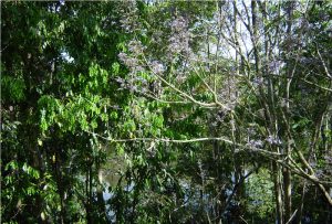
The Amazon River lodge where we stayed caters to an international clientele.  In the open boat that we used to get around in, our group of travelers included a 20 year old British girl seeing the world on her own, a German couple, myself and two sisters, a young man from New Jersey, and three Italian young men.  Guiding the boat with the handle of the outboard motor was our Brazilian guide, Jorge, and his young assistant.  The common language was English so we had no trouble understanding at least the words.   Jorge ferried us along tree  lined passages, through grass meadows growing in the water until we reached the open water just below the tower room that the girls and I stayed in. Heading up stream he came to a small town: a mission, a store and some houses.  Along the banks, cows and pigs stood ankle deep in the water.   Jorge  explained that occasionally, one would fall victim to the teeth of the river, but, they had to drink.  The people who lived there dressed no differently than people you might see in any rural area.  In fact when we got out of the boat and walked along the trails through the rain forest, it looked amazing like the Southern US, except the trees seemed taller.

We then took in a ceremonial dance at another village.  The villagers pulled the front of the boat up out of the water and invited us through the thatch hut village to a lodge.  Along the way, they pointed out a snake skin stretched out on a split log. The skin was easily 18 inches wide and 14 feet long.  Apparently, the predator had been caught feasting on a domesticated pig.  Inside the lodge the dim light revealed several young Brazilian men and women in what passed for tribal garb: loin cloth, bare breasts, and feathers in their ample hair.   We tourists were seated around the periphery of the lodge while the ritual dance was performed.  Then they invited some of us to join in.  Of course, I did.

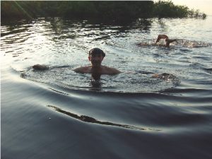
Piling back into the boat,  Jorge asked if we wanted to go to the beach.  Laughingly, we affirmed that we did.  He turned the engine up and headed back downstream to a cove with a sandy bank that looked very much like the place where we had fished for piranhas.  He said he could put us out on the beach or we could swim to shore.  No one seemed enthused about going ashore.  Then he said that we could swim from the boat, but not to get into the water if we had any cuts or scrapes that might bleed.  About that time, his assistant dove overboard.  I told the sisters that if it was ok for him, then I was going to go in as well.  The Italian guys heard this and laughed saying “No guts, Mr. Brave American!”  Since they had called my bluff, I had no choice, so stripping off my shirt and handing my glasses to the girls, I slipped over the side into the dark waters of the Amazon and swam away from the boat.   It was a little disconcerting, but I looked back at

our Italian friends and said: “Your turn.”   They stayed in the boat, but the German guy and the kid from New Jersey jumped in as well.  I’d had my fill of the foolishness pretty soon and pulled myself over the side of the boat with more than just a little relief.  The others followed close behind and the Italians just muttered: “Crazy.”

The Mayan Calendar and doomsday

The Mayan Calendar is said to be nearing the end of a “long count”, which is believed by some to signal an apocalyptic change.  On one of our trips to the Riviera Maya, we visited Chichen Itza which contains the ruins of a city from over 1500 years ago.  While the Europeans were suffering through the Dark Ages, along the Yucatan Penisula and across Mexico a civilization was flurishing that had incredible astronomical knowledge.  For example, at Chichen Itza you can see a four sided pyramid that has 365 levels from top to bottom.  Known as the  Pyramid of Kukulcan, this remnent from the lost civilization is laid out such that two of its edges have carved serpents heads on the lowest level.  On the Spring and Fall equinox, the shadows of the pyramid levels falling on one another along the edges form the shadowy body of the serpent coming down the pyramid and the ending at the sculptured head.   If you go back to the long count on the Mayan Calendar, a recent explanation helped understand what the long count relates to: when the earth in its transit crosses the mid-pooint of a glactic or universal divide. Apparently it does this every 5,800 years.  So, how did the Mayans know this?  Or is this just coincidence explained by science? 

At any rate, this year might be a good time to take that Vacation to Cancun or Puerto Morales and run down the road to Chichen Itza. If you do, plan for a full day and then you won’t see it all.  In addition to the  Pyramid of Kukulcan, there is also an ancient stadium at which the teams competed for honor in a deadly game resembling Lacrosse.  Within walking distance is an observatory housing and Cenotes in which cerimonial sacrifices were made.  I’ll come back and write about these on another day.

Goneguru’s Travel and Recreation Blog

I’m the Traveler at Goneguru.com. My wife is the Seer.  Together and separately we have had the great good fortune to have hiked, biked, run, traveled and enjoyed such places and things as: backpacking in the Grand Canyon, the White Mountains, Cumberland Island; hiking along the Appalachian Trail, along the Highline in Glacier National Park, to the top of Mount LeConte in Tennessee, and along the coast from Villa Jovis to Marina Piccolo on the Isle of Capri. One or both of us have traveled to Rome, Venice, Florence, Gibraltar, Madrid the Coast of Spain, Costa Rica, the Riviera Maya, San Diego to Maine, and Alaska to St. Thomas.  We’ve swam with Pirranha’s, snorkeled on Caribbean reefs, and ridden our bicycles from border to border.  We’ve done tri-athlons, du-athalons, half-marathons and the Peachtree Road Race.  All of this requires a great appreciation and love of food and travel and most of all meeting people. We intend to recreate our travels for our readers, to share our experiences from the past and future, and hopefully meet up with you along the way.