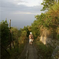
Hiking the Southern Presidential Range of the White Mountains along the Appalachian Trail is a test for an outdoor adventurer of any level. The mountains are beautiful, but the layer of soil over the granite building blocks of the mountains is extremely thin and you will find yourself walking on, over and around areas of exposed rock throughout the hike. That should not dissuade you from the hike, however, since in our group were people in their early twenties and mid-seventies. Each handled the rigors of the hike and finished with smiles. We met at the AMC Highlands Center at Crawford Notch in northern New Hampshire and followed a well marked trail that crossed the road and lead us up the mountain to the AT. There are stretches along this hiking trail where you will believe it was designed for goats.

Note that the Highland Center is at 1900 feet above sea level. In a few hours or so you’ll reach the AT and from there on you follow the ridges and flanks of the mountains. It was on this hike that we learned the meaning of the term “peak bagging.” During our first night on the trail, at a hut named Mitzpah Spring Hut, one of the AMC hut workers gave a seminar on the subject. At first I thought he was saying Peat Bagging, then he explained that peak bagging entailed reaching the summit of a named mountain rising at least 4000 feet above sea level (asl). Mitzpah Spring Hut sits at 3800 feet asl on the south flank of Mt. Pierce. To get to Mitzpah Spring, we scrambled up the access trail to the summit of Mt. Webster where we picked up the AT and headed north, summitting Mt. Jackson before getting there. So we had “bagged” our first peak on this hike before we even knew what the term meant. The “hut” sleeps 60 in coed bunkrooms that accomodate up to 8 people. You must eat what you put on your plate because everything used at the hut must be carried in and everything left must be carried out. After the hike from Crawford Notch, you will have no trouble cleaning your plate.
The next morning, we hustled up Mt. Pierce, bagging our second peak and set off up the AT toward our goal for the evening. The summit of Mt. Washington which is one of the the highest peaks east of the Mississppi River and the site of the highest recorded winds on any continent on earth, clocking in at over 200mph. To get there we followed the AT and loop trails to summit Mt. Franklin, Mt. Monroe and Mt. Eisenhower before we reached the Lake of the Clouds Hut in the saddle between Mt. Eisenhower and Mt. Washington.

After checking in at the hut, which sits at 5050 feet asl, we dropped our backpacks and headed up Mt. Washington. We reached the peak late in the afternoon and rather than backtrack down the trail we headed down the far side of Mt. Washington and back around the flank of the mountain to Lakes of the Clouds Hut. Our plates were dutifully cleaned and we were elated to sit at the dining hall tables and look at a beautiful New Hampshire sunset.

I’ll post more pictures of the terrain in the next post on hiking the Southern Presidential Range.


Mt. Mitchell in North Carolina is the highest peak in the U.S. east of the Mississippi at 6684 feet. Mt. Washington is 6288 feet.